
KEV Kevo, Finland - Earthquake Result Viewer
| ||||||||||||||||||
| ||||||||||||||||||
| ||||||||||||||||||
|
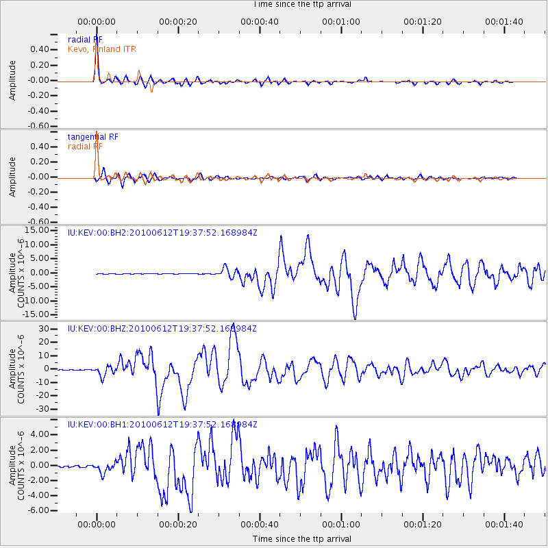
Signal To Noise
| Channel | StoN | STA | LTA |
| IU:KEV:00:BHZ:20100612T19:37:52.168984Z | 25.008194 | 3.755079E-6 | 1.5015394E-7 |
| IU:KEV:00:BH1:20100612T19:37:52.168984Z | 8.446655 | 6.717593E-7 | 7.952962E-8 |
| IU:KEV:00:BH2:20100612T19:37:52.168984Z | 24.844059 | 1.66897E-6 | 6.717783E-8 |
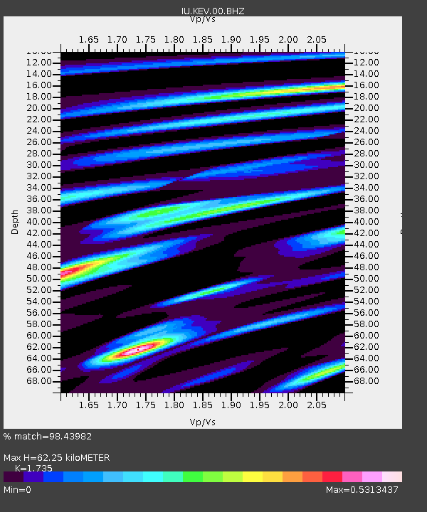
| Arrivals | |
| Ps | 7.2 SECOND |
| PpPs | 25 SECOND |
| PsPs/PpSs | 32 SECOND |

