GTBY Guantanamo Bay, Cuba - Earthquake Result Viewer
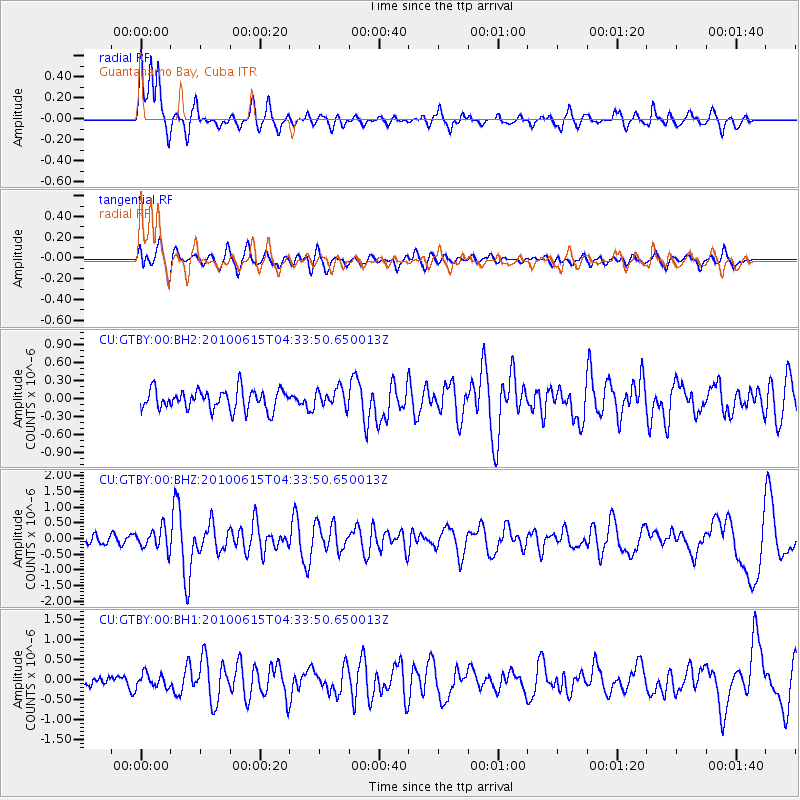
Earthquake location: Calif.-Baja Calif. Border Region
Earthquake latitude/longitude: 32.7/-115.9
Earthquake time(UTC): 2010/06/15 (166) 04:26:58 GMT
Earthquake Depth: 5.4 km
Earthquake Magnitude: 5.8 MW, 5.6 MB, 5.7 MS, 5.8 MW
Earthquake Catalog/Contributor: NEIC PDE/NEIC PDE-M
Network: CU Caribbean Network (USGS)
Station: GTBY Guantanamo Bay, Cuba
Lat/Lon: 19.93 N/75.11 W
Elevation: 79 m
Distance: 38.5 deg
Az: 98.985 deg
Baz: 297.729 deg
Ray Param: 0.0755366
Estimated Moho Depth: 14.5 km
Estimated Crust Vp/Vs: 1.70
Assumed Crust Vp: 6.048 km/s
Estimated Crust Vs: 3.552 km/s
Estimated Crust Poisson's Ratio: 0.24
Radial Match: 83.830055 %
Radial Bump: 400
Transverse Match: 57.01563 %
Transverse Bump: 400
SOD ConfigId: 617450
Insert Time: 2013-10-01 06:23:35.606 +0000
GWidth: 2.5
Max Bumps: 400
Tol: 0.001

Signal To Noise

ChannelStoNSTALTA
CU:GTBY:00:BHZ:20100615T04:33:50.650013Z2.21199443.3481538E-71.5136358E-7
CU:GTBY:00:BH1:20100615T04:33:50.650013Z1.17719241.6956774E-71.440442E-7
CU:GTBY:00:BH2:20100615T04:33:50.650013Z0.93544351.5542793E-71.6615427E-7
Arrivals
Ps1.8 SECOND
PpPs6.1 SECOND
PsPs/PpSs7.9 SECOND