You are here: Home > Network List > CN - Canadian National Seismograph Network Stations List
> Station INK INUVIK, NT > Earthquake Result Viewer
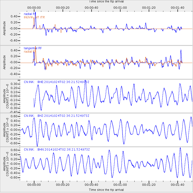
INK INUVIK, NT - Earthquake Result Viewer
*The percent match for this event was below the threshold and hence no stack was calculated.
| Earthquake location: |
Northern Molucca Sea |
| Earthquake latitude/longitude: |
1.4/126.4 |
| Earthquake time(UTC): |
2014/10/24 (297) 02:23:48 GMT |
| Earthquake Depth: |
59 km |
| Earthquake Magnitude: |
5.1 MW |
| Earthquake Catalog/Contributor: |
ISC/ISC |
|
| Network: |
CN Canadian National Seismograph Network |
| Station: |
INK INUVIK, NT |
| Lat/Lon: |
68.31 N/133.53 W |
| Elevation: |
44 m |
|
| Distance: |
92.4 deg |
| Az: |
21.494 deg |
| Baz: |
279.858 deg |
| Ray Param: |
$rayparam |
*The percent match for this event was below the threshold and hence was not used in the summary stack. |
|
| Radial Match: |
69.81193 % |
| Radial Bump: |
300 |
| Transverse Match: |
31.931551 % |
| Transverse Bump: |
400 |
| SOD ConfigId: |
3390531 |
| Insert Time: |
2019-04-14 17:09:54.966 +0000 |
| GWidth: |
2.5 |
| Max Bumps: |
400 |
| Tol: |
0.001 |
|
Signal To Noise
| Channel | StoN | STA | LTA |
| CN:INK: :BHZ:20141024T02:36:21.524973Z | 2.7348 | 4.3780688E-7 | 1.6008734E-7 |
| CN:INK: :BHN:20141024T02:36:21.524973Z | 1.0272727 | 1.8025159E-7 | 1.7546616E-7 |
| CN:INK: :BHE:20141024T02:36:21.524973Z | 1.2121687 | 1.6516485E-7 | 1.3625566E-7 |
| Arrivals |
| Ps | |
| PpPs | |
| PsPs/PpSs | |


