You are here: Home > Network List > IU - Global Seismograph Network (GSN - IRIS/USGS) Stations List
> Station HNR Honiara, Solomon Islands > Earthquake Result Viewer
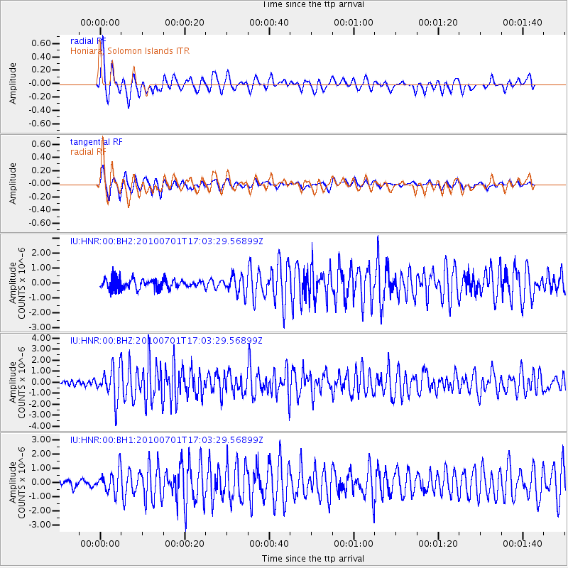
HNR Honiara, Solomon Islands - Earthquake Result Viewer
*The percent match for this event was below the threshold and hence no stack was calculated.
| Earthquake location: |
Banda Sea |
| Earthquake latitude/longitude: |
-5.2/129.4 |
| Earthquake time(UTC): |
2010/07/01 (182) 16:57:49 GMT |
| Earthquake Depth: |
36 km |
| Earthquake Magnitude: |
5.7 MB, 5.2 MS, 5.8 MW |
| Earthquake Catalog/Contributor: |
WHDF/NEIC |
|
| Network: |
IU Global Seismograph Network (GSN - IRIS/USGS) |
| Station: |
HNR Honiara, Solomon Islands |
| Lat/Lon: |
9.44 S/159.95 E |
| Elevation: |
100 m |
|
| Distance: |
30.6 deg |
| Az: |
99.75 deg |
| Baz: |
275.794 deg |
| Ray Param: |
$rayparam |
*The percent match for this event was below the threshold and hence was not used in the summary stack. |
|
| Radial Match: |
70.082214 % |
| Radial Bump: |
400 |
| Transverse Match: |
76.025566 % |
| Transverse Bump: |
400 |
| SOD ConfigId: |
617450 |
| Insert Time: |
2013-10-01 07:05:42.356 +0000 |
| GWidth: |
2.5 |
| Max Bumps: |
400 |
| Tol: |
0.001 |
|
Signal To Noise
| Channel | StoN | STA | LTA |
| IU:HNR:00:BHZ:20100701T17:03:29.56899Z | 4.903943 | 1.4785165E-6 | 3.0149548E-7 |
| IU:HNR:00:BH1:20100701T17:03:29.56899Z | 2.8018427 | 8.2208413E-7 | 2.9340836E-7 |
| IU:HNR:00:BH2:20100701T17:03:29.56899Z | 1.8993634 | 5.9489867E-7 | 3.132095E-7 |
| Arrivals |
| Ps | |
| PpPs | |
| PsPs/PpSs | |


