KURK Kurchatov, Kazakhstan - Earthquake Result Viewer
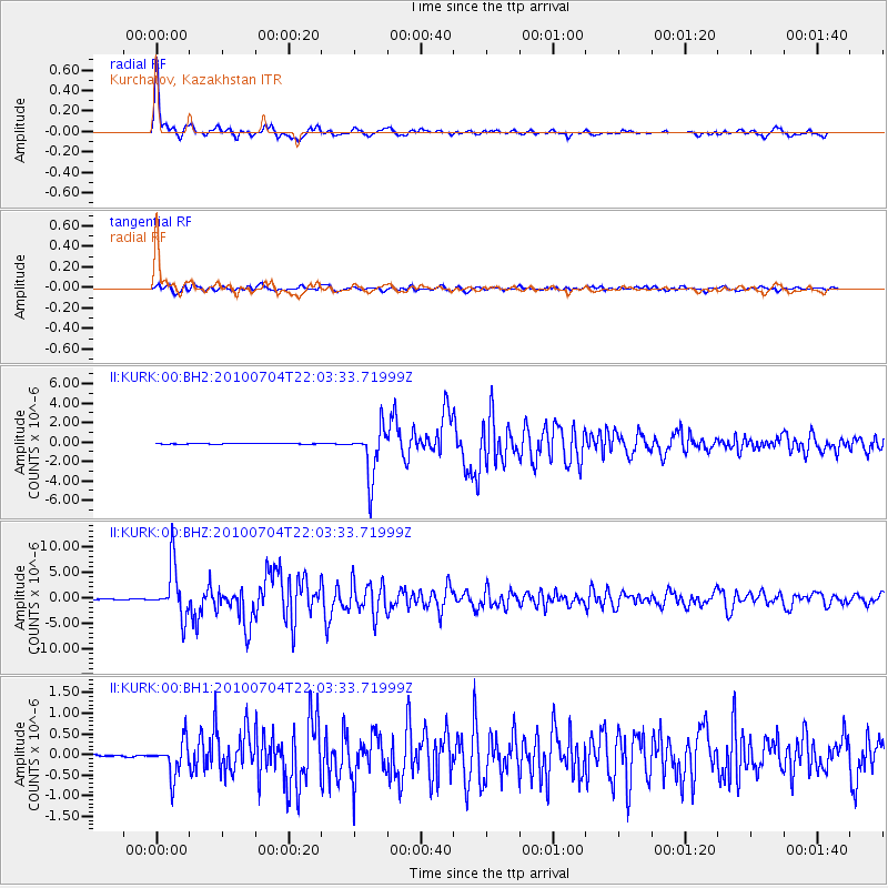
Earthquake location: Near East Coast Of Honshu, Japan
Earthquake latitude/longitude: 39.7/142.4
Earthquake time(UTC): 2010/07/04 (185) 21:55:51 GMT
Earthquake Depth: 27 km
Earthquake Magnitude: 6.4 MB, 6.1 MS, 6.3 MW, 6.2 MW
Earthquake Catalog/Contributor: WHDF/NEIC
Network: II Global Seismograph Network (GSN - IRIS/IDA)
Station: KURK Kurchatov, Kazakhstan
Lat/Lon: 50.72 N/78.62 E
Elevation: 184 m
Distance: 44.9 deg
Az: 306.16 deg
Baz: 78.482 deg
Ray Param: 0.07156729
Estimated Moho Depth: 42.25 km
Estimated Crust Vp/Vs: 1.75
Assumed Crust Vp: 6.552 km/s
Estimated Crust Vs: 3.755 km/s
Estimated Crust Poisson's Ratio: 0.26
Radial Match: 97.7318 %
Radial Bump: 310
Transverse Match: 91.60608 %
Transverse Bump: 400
SOD ConfigId: 617450
Insert Time: 2013-10-01 07:10:43.017 +0000
GWidth: 2.5
Max Bumps: 400
Tol: 0.001

Signal To Noise

ChannelStoNSTALTA
II:KURK:00:BHZ:20100704T22:03:33.71999Z66.014235.001826E-67.576891E-8
II:KURK:00:BH1:20100704T22:03:33.71999Z10.0169464.2634196E-74.256207E-8
II:KURK:00:BH2:20100704T22:03:33.71999Z78.920542.5490037E-63.229836E-8
Arrivals
Ps5.1 SECOND
PpPs17 SECOND
PsPs/PpSs22 SECOND