KEV Kevo, Finland - Earthquake Result Viewer
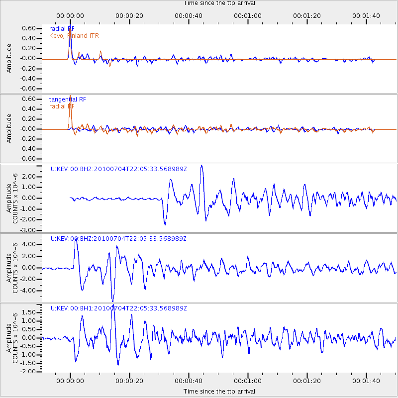
Earthquake location: Near East Coast Of Honshu, Japan
Earthquake latitude/longitude: 39.7/142.4
Earthquake time(UTC): 2010/07/04 (185) 21:55:51 GMT
Earthquake Depth: 27 km
Earthquake Magnitude: 6.4 MB, 6.1 MS, 6.3 MW, 6.2 MW
Earthquake Catalog/Contributor: WHDF/NEIC
Network: IU Global Seismograph Network (GSN - IRIS/USGS)
Station: KEV Kevo, Finland
Lat/Lon: 69.76 N/27.00 E
Elevation: 100 m
Distance: 61.2 deg
Az: 338.973 deg
Baz: 52.69 deg
Ray Param: 0.060971107
Estimated Moho Depth: 58.75 km
Estimated Crust Vp/Vs: 1.62
Assumed Crust Vp: 6.622 km/s
Estimated Crust Vs: 4.1 km/s
Estimated Crust Poisson's Ratio: 0.19
Radial Match: 96.48234 %
Radial Bump: 365
Transverse Match: 85.92865 %
Transverse Bump: 400
SOD ConfigId: 617450
Insert Time: 2013-10-01 07:11:08.512 +0000
GWidth: 2.5
Max Bumps: 400
Tol: 0.001

Signal To Noise

ChannelStoNSTALTA
IU:KEV:00:BHZ:20100704T22:05:33.568989Z26.0582772.6668545E-61.0234194E-7
IU:KEV:00:BH1:20100704T22:05:33.568989Z12.5061577.644476E-76.11257E-8
IU:KEV:00:BH2:20100704T22:05:33.568989Z17.0798851.2206972E-67.146987E-8
Arrivals
Ps5.8 SECOND
PpPs22 SECOND
PsPs/PpSs28 SECOND