You are here: Home > Network List > II - Global Seismograph Network (GSN - IRIS/IDA) Stations List
> Station MSEY Mahe, Seychelles > Earthquake Result Viewer
MSEY Mahe, Seychelles - Earthquake Result Viewer

| Earthquake location: |
Mindanao, Philippines |
| Earthquake latitude/longitude: |
6.7/123.4 |
| Earthquake time(UTC): |
2010/07/23 (204) 22:08:11 GMT |
| Earthquake Depth: |
607 km |
| Earthquake Magnitude: |
6.3 MB, 7.3 MW, 7.3 MW |
| Earthquake Catalog/Contributor: |
WHDF/NEIC |
|
| Network: |
II Global Seismograph Network (GSN - IRIS/IDA) |
| Station: |
MSEY Mahe, Seychelles |
| Lat/Lon: |
4.67 S/55.48 E |
| Elevation: |
475 m |
|
| Distance: |
68.7 deg |
| Az: |
262.359 deg |
| Baz: |
80.985 deg |
| Ray Param: |
0.053936947 |
| Estimated Moho Depth: |
58.75 km |
| Estimated Crust Vp/Vs: |
1.95 |
| Assumed Crust Vp: |
6.303 km/s |
| Estimated Crust Vs: |
3.24 km/s |
| Estimated Crust Poisson's Ratio: |
0.32 |
|
| Radial Match: |
88.703575 % |
| Radial Bump: |
330 |
| Transverse Match: |
64.3071 % |
| Transverse Bump: |
361 |
| SOD ConfigId: |
617450 |
| Insert Time: |
2013-10-01 08:24:50.663 +0000 |
| GWidth: |
2.5 |
| Max Bumps: |
400 |
| Tol: |
0.001 |
|
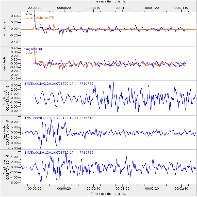
Signal To Noise
| Channel | StoN | STA | LTA |
| II:MSEY:00:BHZ:20100723T22:17:44.771973Z | 8.828881 | 6.541741E-6 | 7.409479E-7 |
| II:MSEY:00:BH1:20100723T22:17:44.771973Z | 3.6427133 | 2.6149319E-6 | 7.178528E-7 |
| II:MSEY:00:BH2:20100723T22:17:44.771973Z | 0.8302238 | 7.888906E-7 | 9.502144E-7 |
| Arrivals |
| Ps | 9.1 SECOND |
| PpPs | 27 SECOND |
| PsPs/PpSs | 36 SECOND |


