You are here: Home > Network List > IU - Global Seismograph Network (GSN - IRIS/USGS) Stations List
> Station HNR Honiara, Solomon Islands > Earthquake Result Viewer
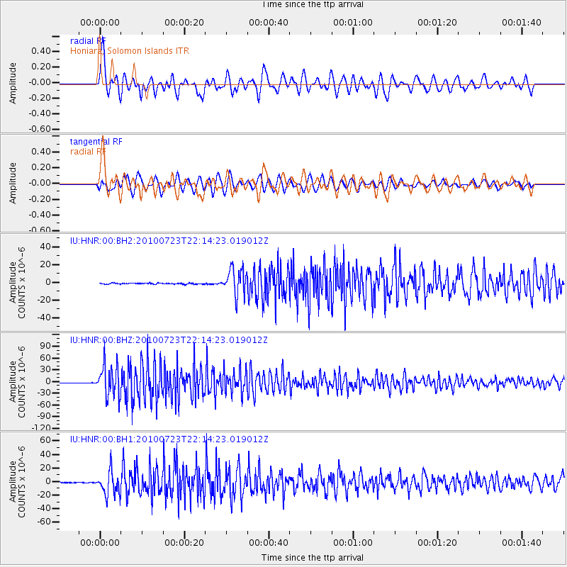
HNR Honiara, Solomon Islands - Earthquake Result Viewer
*The percent match for this event was below the threshold and hence no stack was calculated.
| Earthquake location: |
Mindanao, Philippines |
| Earthquake latitude/longitude: |
6.7/123.4 |
| Earthquake time(UTC): |
2010/07/23 (204) 22:08:11 GMT |
| Earthquake Depth: |
607 km |
| Earthquake Magnitude: |
6.3 MB, 7.3 MW, 7.3 MW |
| Earthquake Catalog/Contributor: |
WHDF/NEIC |
|
| Network: |
IU Global Seismograph Network (GSN - IRIS/USGS) |
| Station: |
HNR Honiara, Solomon Islands |
| Lat/Lon: |
9.44 S/159.95 E |
| Elevation: |
100 m |
|
| Distance: |
39.8 deg |
| Az: |
113.379 deg |
| Baz: |
292.478 deg |
| Ray Param: |
$rayparam |
*The percent match for this event was below the threshold and hence was not used in the summary stack. |
|
| Radial Match: |
59.126335 % |
| Radial Bump: |
400 |
| Transverse Match: |
63.191456 % |
| Transverse Bump: |
400 |
| SOD ConfigId: |
617450 |
| Insert Time: |
2013-10-01 08:25:10.202 +0000 |
| GWidth: |
2.5 |
| Max Bumps: |
400 |
| Tol: |
0.001 |
|
Signal To Noise
| Channel | StoN | STA | LTA |
| IU:HNR:00:BHZ:20100723T22:14:23.019012Z | 80.06518 | 3.989014E-5 | 4.9822086E-7 |
| IU:HNR:00:BH1:20100723T22:14:23.019012Z | 37.27025 | 1.7613083E-5 | 4.7257757E-7 |
| IU:HNR:00:BH2:20100723T22:14:23.019012Z | 27.619272 | 1.5043392E-5 | 5.4467006E-7 |
| Arrivals |
| Ps | |
| PpPs | |
| PsPs/PpSs | |


