You are here: Home > Network List > IU - Global Seismograph Network (GSN - IRIS/USGS) Stations List
> Station HNR Honiara, Solomon Islands > Earthquake Result Viewer
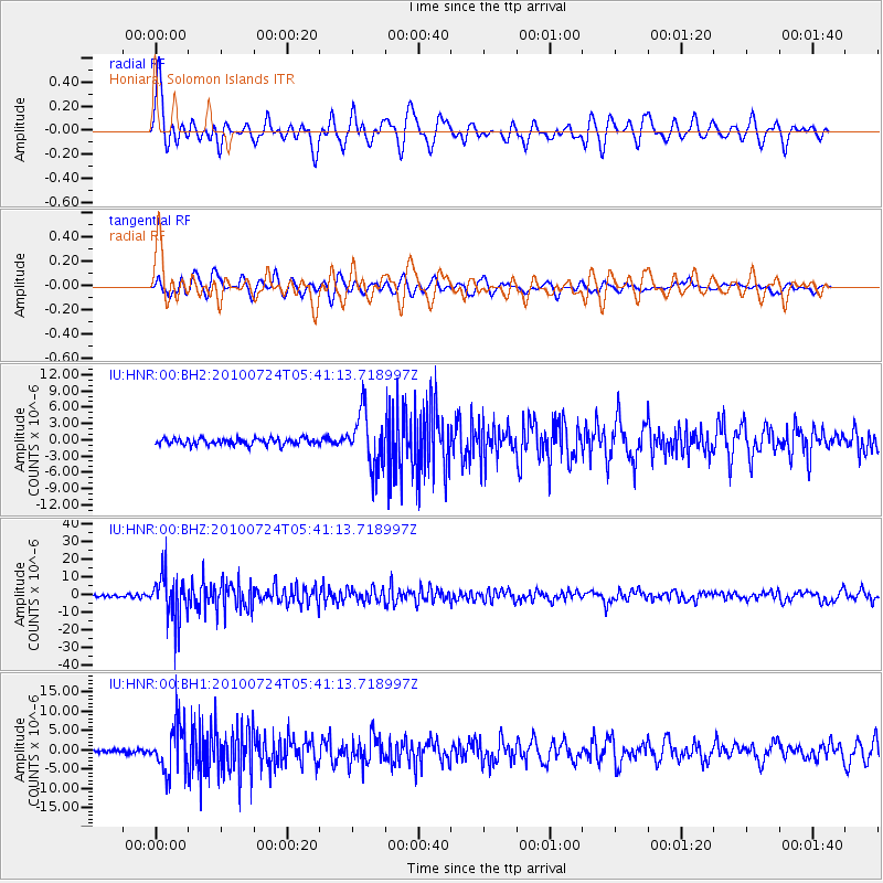
HNR Honiara, Solomon Islands - Earthquake Result Viewer
*The percent match for this event was below the threshold and hence no stack was calculated.
| Earthquake location: |
Mindanao, Philippines |
| Earthquake latitude/longitude: |
6.2/123.5 |
| Earthquake time(UTC): |
2010/07/24 (205) 05:35:01 GMT |
| Earthquake Depth: |
553 km |
| Earthquake Magnitude: |
5.9 MB, 6.6 MW, 6.5 MW |
| Earthquake Catalog/Contributor: |
WHDF/NEIC |
|
| Network: |
IU Global Seismograph Network (GSN - IRIS/USGS) |
| Station: |
HNR Honiara, Solomon Islands |
| Lat/Lon: |
9.44 S/159.95 E |
| Elevation: |
100 m |
|
| Distance: |
39.5 deg |
| Az: |
112.892 deg |
| Baz: |
291.829 deg |
| Ray Param: |
$rayparam |
*The percent match for this event was below the threshold and hence was not used in the summary stack. |
|
| Radial Match: |
71.99686 % |
| Radial Bump: |
400 |
| Transverse Match: |
62.75999 % |
| Transverse Bump: |
400 |
| SOD ConfigId: |
617450 |
| Insert Time: |
2013-10-01 08:43:01.958 +0000 |
| GWidth: |
2.5 |
| Max Bumps: |
400 |
| Tol: |
0.001 |
|
Signal To Noise
| Channel | StoN | STA | LTA |
| IU:HNR:00:BHZ:20100724T05:41:13.718997Z | 19.061678 | 1.3433941E-5 | 7.047617E-7 |
| IU:HNR:00:BH1:20100724T05:41:13.718997Z | 9.914737 | 5.8602295E-6 | 5.910626E-7 |
| IU:HNR:00:BH2:20100724T05:41:13.718997Z | 8.377006 | 5.0586727E-6 | 6.03876E-7 |
| Arrivals |
| Ps | |
| PpPs | |
| PsPs/PpSs | |


