AAK Ala Archa, Kyrgyzstan - Earthquake Result Viewer
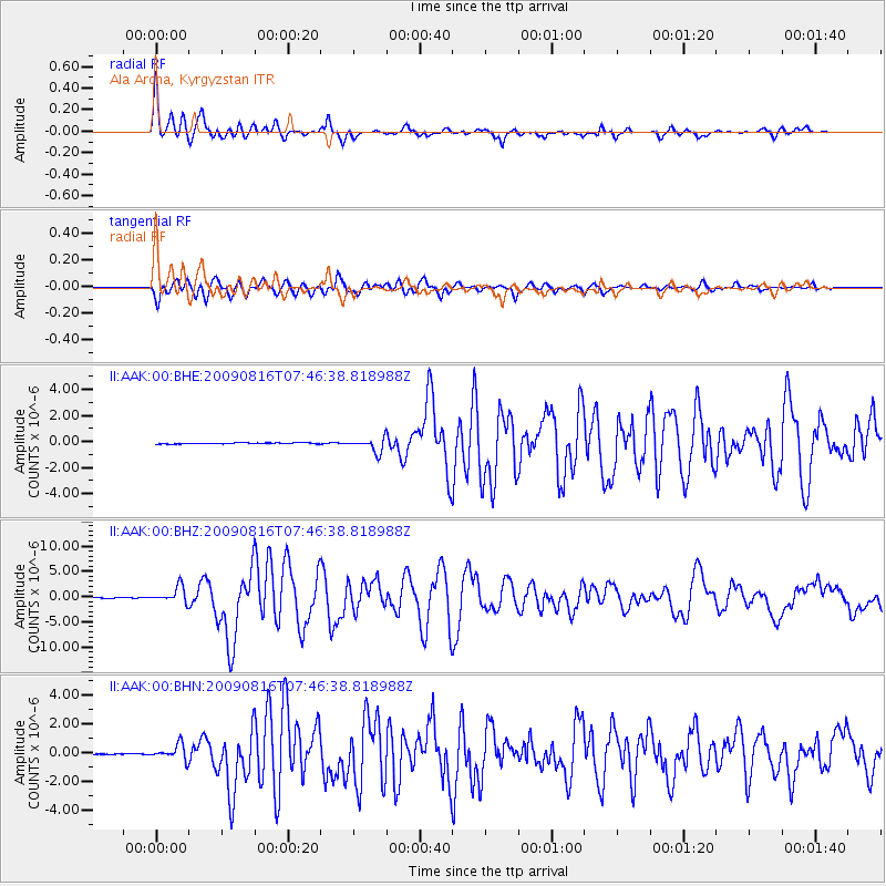
Earthquake location: Southern Sumatra, Indonesia
Earthquake latitude/longitude: -1.5/99.5
Earthquake time(UTC): 2009/08/16 (228) 07:38:21 GMT
Earthquake Depth: 20 km
Earthquake Magnitude: 6.5 MB, 6.7 MS, 6.7 MW, 6.5 MW
Earthquake Catalog/Contributor: WHDF/NEIC
Network: II Global Seismograph Network (GSN - IRIS/IDA)
Station: AAK Ala Archa, Kyrgyzstan
Lat/Lon: 42.64 N/74.49 E
Elevation: 1645 m
Distance: 49.4 deg
Az: 335.739 deg
Baz: 146.176 deg
Ray Param: 0.06872296
Estimated Moho Depth: 15.75 km
Estimated Crust Vp/Vs: 1.83
Assumed Crust Vp: 6.306 km/s
Estimated Crust Vs: 3.441 km/s
Estimated Crust Poisson's Ratio: 0.29
Radial Match: 93.59562 %
Radial Bump: 376
Transverse Match: 92.55089 %
Transverse Bump: 400
SOD ConfigId: 2622
Insert Time: 2010-03-01 15:39:08.843 +0000
GWidth: 2.5
Max Bumps: 400
Tol: 0.001

Signal To Noise

ChannelStoNSTALTA
II:AAK:00:BHZ:20090816T07:46:38.818988Z30.5391651.5771823E-65.1644577E-8
II:AAK:00:BHN:20090816T07:46:38.818988Z12.1385995.3786044E-74.4309928E-8
II:AAK:00:BHE:20090816T07:46:38.818988Z12.30960755.273214E-74.2838195E-8
Arrivals
Ps2.2 SECOND
PpPs6.7 SECOND
PsPs/PpSs8.9 SECOND