You are here: Home > Network List > II - Global Seismograph Network (GSN - IRIS/IDA) Stations List
> Station PFO Pinon Flat, California, USA > Earthquake Result Viewer
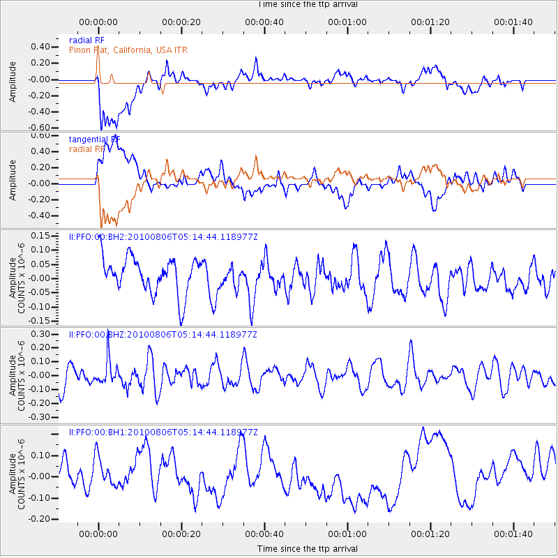
PFO Pinon Flat, California, USA - Earthquake Result Viewer
*The percent match for this event was below the threshold and hence no stack was calculated.
| Earthquake location: |
Fiji Islands Region |
| Earthquake latitude/longitude: |
-21.8/-179.5 |
| Earthquake time(UTC): |
2010/08/06 (218) 05:03:59 GMT |
| Earthquake Depth: |
595 km |
| Earthquake Magnitude: |
5.5 MW |
| Earthquake Catalog/Contributor: |
NEIC PDE/NEIC PDE-M |
|
| Network: |
II Global Seismograph Network (GSN - IRIS/IDA) |
| Station: |
PFO Pinon Flat, California, USA |
| Lat/Lon: |
33.61 N/116.46 W |
| Elevation: |
1280 m |
|
| Distance: |
81.4 deg |
| Az: |
48.759 deg |
| Baz: |
236.887 deg |
| Ray Param: |
$rayparam |
*The percent match for this event was below the threshold and hence was not used in the summary stack. |
|
| Radial Match: |
46.269066 % |
| Radial Bump: |
400 |
| Transverse Match: |
26.354221 % |
| Transverse Bump: |
400 |
| SOD ConfigId: |
617450 |
| Insert Time: |
2013-10-01 09:35:14.158 +0000 |
| GWidth: |
2.5 |
| Max Bumps: |
400 |
| Tol: |
0.001 |
|
Signal To Noise
| Channel | StoN | STA | LTA |
| II:PFO:00:BHZ:20100806T05:14:44.118977Z | 1.4903349 | 9.416015E-8 | 6.318053E-8 |
| II:PFO:00:BH1:20100806T05:14:44.118977Z | 1.0164464 | 1.1514766E-7 | 1.13284536E-7 |
| II:PFO:00:BH2:20100806T05:14:44.118977Z | 0.56492525 | 3.589383E-8 | 6.353731E-8 |
| Arrivals |
| Ps | |
| PpPs | |
| PsPs/PpSs | |


