You are here: Home > Network List > IU - Global Seismograph Network (GSN - IRIS/USGS) Stations List
> Station JOHN Johnston Island, USA > Earthquake Result Viewer
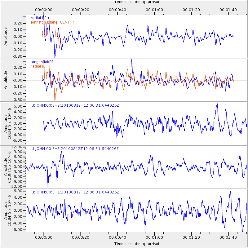
JOHN Johnston Island, USA - Earthquake Result Viewer
*The percent match for this event was below the threshold and hence no stack was calculated.
| Earthquake location: |
Ecuador |
| Earthquake latitude/longitude: |
-1.3/-77.3 |
| Earthquake time(UTC): |
2010/08/12 (224) 11:54:15 GMT |
| Earthquake Depth: |
207 km |
| Earthquake Magnitude: |
6.4 MB, 7.1 MW, 7.1 MW |
| Earthquake Catalog/Contributor: |
WHDF/NEIC |
|
| Network: |
IU Global Seismograph Network (GSN - IRIS/USGS) |
| Station: |
JOHN Johnston Island, USA |
| Lat/Lon: |
16.73 N/169.53 W |
| Elevation: |
2.0 m |
|
| Distance: |
92.5 deg |
| Az: |
286.59 deg |
| Baz: |
90.57 deg |
| Ray Param: |
$rayparam |
*The percent match for this event was below the threshold and hence was not used in the summary stack. |
|
| Radial Match: |
68.07571 % |
| Radial Bump: |
400 |
| Transverse Match: |
69.99152 % |
| Transverse Bump: |
400 |
| SOD ConfigId: |
617450 |
| Insert Time: |
2013-10-01 09:56:12.531 +0000 |
| GWidth: |
2.5 |
| Max Bumps: |
400 |
| Tol: |
0.001 |
|
Signal To Noise
| Channel | StoN | STA | LTA |
| IU:JOHN:00:BHZ:20100812T12:06:31.644026Z | 3.56834 | 4.054773E-6 | 1.1363192E-6 |
| IU:JOHN:00:BH1:20100812T12:06:31.644026Z | 1.2663952 | 1.2430681E-6 | 9.8158E-7 |
| IU:JOHN:00:BH2:20100812T12:06:31.644026Z | 1.3629961 | 1.4746354E-6 | 1.0819073E-6 |
| Arrivals |
| Ps | |
| PpPs | |
| PsPs/PpSs | |


