You are here: Home > Network List > II - Global Seismograph Network (GSN - IRIS/IDA) Stations List
> Station PFO Pinon Flat, California, USA > Earthquake Result Viewer
PFO Pinon Flat, California, USA - Earthquake Result Viewer
*The percent match for this event was below the threshold and hence no stack was calculated.
| Earthquake location: |
Azores Islands Region |
| Earthquake latitude/longitude: |
36.9/-32.9 |
| Earthquake time(UTC): |
2010/08/13 (225) 07:58:48 GMT |
| Earthquake Depth: |
10 km |
| Earthquake Magnitude: |
5.5 MW |
| Earthquake Catalog/Contributor: |
NEIC PDE/NEIC PDE-M |
|
| Network: |
II Global Seismograph Network (GSN - IRIS/IDA) |
| Station: |
PFO Pinon Flat, California, USA |
| Lat/Lon: |
33.61 N/116.46 W |
| Elevation: |
1280 m |
|
| Distance: |
66.2 deg |
| Az: |
294.963 deg |
| Baz: |
60.585 deg |
| Ray Param: |
$rayparam |
*The percent match for this event was below the threshold and hence was not used in the summary stack. |
|
| Radial Match: |
69.23409 % |
| Radial Bump: |
400 |
| Transverse Match: |
68.33729 % |
| Transverse Bump: |
400 |
| SOD ConfigId: |
617450 |
| Insert Time: |
2013-10-01 09:57:59.419 +0000 |
| GWidth: |
2.5 |
| Max Bumps: |
400 |
| Tol: |
0.001 |
|
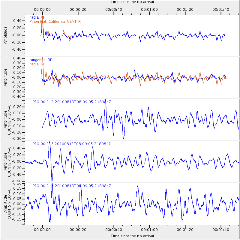
Signal To Noise
| Channel | StoN | STA | LTA |
| II:PFO:00:BHZ:20100813T08:09:05.218984Z | 3.237358 | 2.3958557E-7 | 7.4006515E-8 |
| II:PFO:00:BH1:20100813T08:09:05.218984Z | 2.4702897 | 8.907981E-8 | 3.606047E-8 |
| II:PFO:00:BH2:20100813T08:09:05.218984Z | 1.1457216 | 6.759749E-8 | 5.8999934E-8 |
| Arrivals |
| Ps | |
| PpPs | |
| PsPs/PpSs | |


