You are here: Home > Network List > II - Global Seismograph Network (GSN - IRIS/IDA) Stations List
> Station PFO Pinon Flat, California, USA > Earthquake Result Viewer
PFO Pinon Flat, California, USA - Earthquake Result Viewer
*The percent match for this event was below the threshold and hence no stack was calculated.
| Earthquake location: |
South Of Mariana Islands |
| Earthquake latitude/longitude: |
12.8/143.5 |
| Earthquake time(UTC): |
2010/08/23 (235) 01:08:09 GMT |
| Earthquake Depth: |
124 km |
| Earthquake Magnitude: |
5.6 MB, 5.5 MW |
| Earthquake Catalog/Contributor: |
WHDF/NEIC |
|
| Network: |
II Global Seismograph Network (GSN - IRIS/IDA) |
| Station: |
PFO Pinon Flat, California, USA |
| Lat/Lon: |
33.61 N/116.46 W |
| Elevation: |
1280 m |
|
| Distance: |
91.1 deg |
| Az: |
55.287 deg |
| Baz: |
286.091 deg |
| Ray Param: |
$rayparam |
*The percent match for this event was below the threshold and hence was not used in the summary stack. |
|
| Radial Match: |
66.71965 % |
| Radial Bump: |
400 |
| Transverse Match: |
43.944996 % |
| Transverse Bump: |
400 |
| SOD ConfigId: |
617450 |
| Insert Time: |
2013-10-01 10:39:00.168 +0000 |
| GWidth: |
2.5 |
| Max Bumps: |
400 |
| Tol: |
0.001 |
|
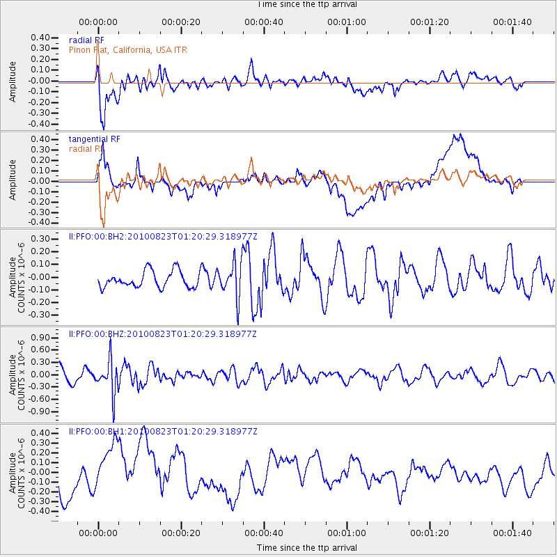
Signal To Noise
| Channel | StoN | STA | LTA |
| II:PFO:00:BHZ:20100823T01:20:29.318977Z | 2.5376117 | 4.09158E-7 | 1.6123744E-7 |
| II:PFO:00:BH1:20100823T01:20:29.318977Z | 2.2773001 | 3.033234E-7 | 1.3319429E-7 |
| II:PFO:00:BH2:20100823T01:20:29.318977Z | 2.1807954 | 1.404038E-7 | 6.438192E-8 |
| Arrivals |
| Ps | |
| PpPs | |
| PsPs/PpSs | |


