
KIP Kipapa - Hawaii, USA - Earthquake Result Viewer
| ||||||||||||||||||
| ||||||||||||||||||
| ||||||||||||||||||
|
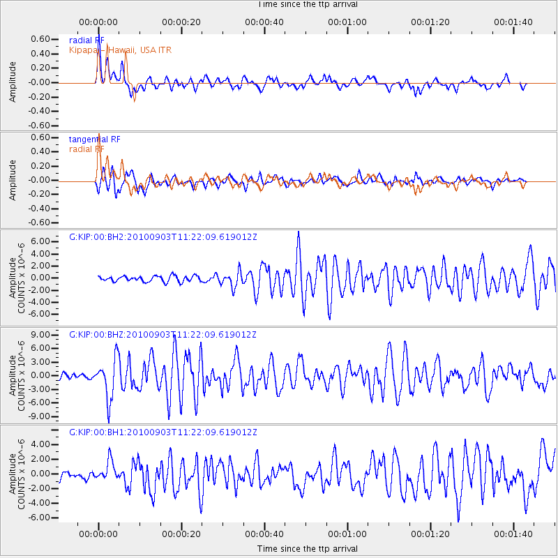
Signal To Noise
| Channel | StoN | STA | LTA |
| G:KIP:00:BHZ:20100903T11:22:09.619012Z | 7.68795 | 4.536338E-6 | 5.900582E-7 |
| G:KIP:00:BH1:20100903T11:22:09.619012Z | 3.0659013 | 1.3828776E-6 | 4.5105094E-7 |
| G:KIP:00:BH2:20100903T11:22:09.619012Z | 2.7235208 | 1.2676529E-6 | 4.654464E-7 |
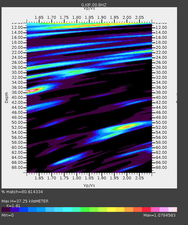
| Arrivals | |
| Ps | 5.6 SECOND |
| PpPs | 22 SECOND |
| PsPs/PpSs | 28 SECOND |

