You are here: Home > Network List > IU - Global Seismograph Network (GSN - IRIS/USGS) Stations List
> Station HNR Honiara, Solomon Islands > Earthquake Result Viewer
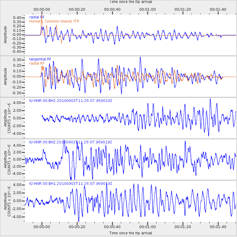
HNR Honiara, Solomon Islands - Earthquake Result Viewer
*The percent match for this event was below the threshold and hence no stack was calculated.
| Earthquake location: |
Andreanof Islands, Aleutian Is. |
| Earthquake latitude/longitude: |
51.5/-175.9 |
| Earthquake time(UTC): |
2010/09/03 (246) 11:16:06 GMT |
| Earthquake Depth: |
24 km |
| Earthquake Magnitude: |
6.5 MW, 6.1 MB, 6.2 MS, 6.3 MW |
| Earthquake Catalog/Contributor: |
NEIC PDE/NEIC PDE-M |
|
| Network: |
IU Global Seismograph Network (GSN - IRIS/USGS) |
| Station: |
HNR Honiara, Solomon Islands |
| Lat/Lon: |
9.44 S/159.95 E |
| Elevation: |
100 m |
|
| Distance: |
64.1 deg |
| Az: |
206.688 deg |
| Baz: |
16.55 deg |
| Ray Param: |
$rayparam |
*The percent match for this event was below the threshold and hence was not used in the summary stack. |
|
| Radial Match: |
61.128796 % |
| Radial Bump: |
400 |
| Transverse Match: |
76.745865 % |
| Transverse Bump: |
400 |
| SOD ConfigId: |
617450 |
| Insert Time: |
2013-10-01 10:50:51.037 +0000 |
| GWidth: |
2.5 |
| Max Bumps: |
400 |
| Tol: |
0.001 |
|
Signal To Noise
| Channel | StoN | STA | LTA |
| IU:HNR:00:BHZ:20100903T11:26:07.969019Z | 2.9796648 | 1.2960587E-6 | 4.3496794E-7 |
| IU:HNR:00:BH1:20100903T11:26:07.969019Z | 0.86418796 | 4.429297E-7 | 5.125386E-7 |
| IU:HNR:00:BH2:20100903T11:26:07.969019Z | 1.1156378 | 5.3970746E-7 | 4.8376586E-7 |
| Arrivals |
| Ps | |
| PpPs | |
| PsPs/PpSs | |


