OTAV Otavalo, Ecuador - Earthquake Result Viewer
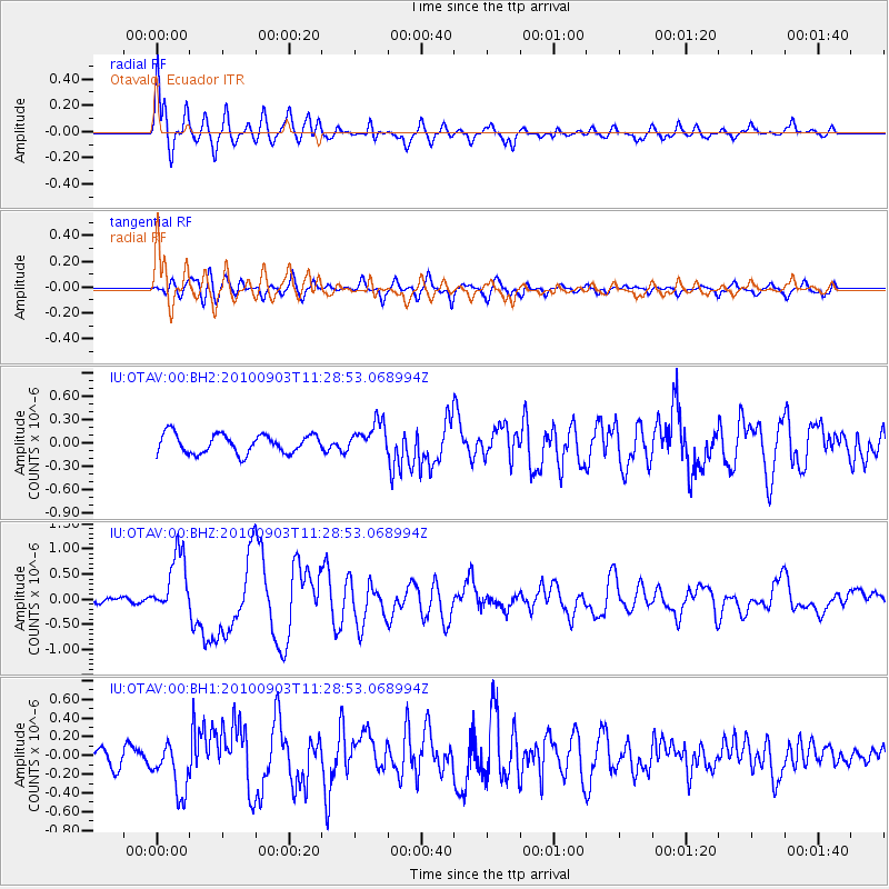
Earthquake location: Andreanof Islands, Aleutian Is.
Earthquake latitude/longitude: 51.5/-175.9
Earthquake time(UTC): 2010/09/03 (246) 11:16:06 GMT
Earthquake Depth: 24 km
Earthquake Magnitude: 6.5 MW, 6.1 MB, 6.2 MS, 6.3 MW
Earthquake Catalog/Contributor: NEIC PDE/NEIC PDE-M
Network: IU Global Seismograph Network (GSN - IRIS/USGS)
Station: OTAV Otavalo, Ecuador
Lat/Lon: 0.24 N/78.45 W
Elevation: 3510 m
Distance: 94.4 deg
Az: 84.053 deg
Baz: 321.51 deg
Ray Param: 0.041033477
Estimated Moho Depth: 11.5 km
Estimated Crust Vp/Vs: 1.74
Assumed Crust Vp: 6.472 km/s
Estimated Crust Vs: 3.725 km/s
Estimated Crust Poisson's Ratio: 0.25
Radial Match: 87.78087 %
Radial Bump: 400
Transverse Match: 71.62027 %
Transverse Bump: 400
SOD ConfigId: 617450
Insert Time: 2013-10-01 10:50:56.870 +0000
GWidth: 2.5
Max Bumps: 400
Tol: 0.001

Signal To Noise

ChannelStoNSTALTA
IU:OTAV:00:BHZ:20100903T11:28:53.068994Z8.1858286.0997814E-77.4516365E-8
IU:OTAV:00:BH1:20100903T11:28:53.068994Z3.54379942.6903646E-77.591753E-8
IU:OTAV:00:BH2:20100903T11:28:53.068994Z1.64692162.0099972E-71.2204572E-7
Arrivals
Ps1.3 SECOND
PpPs4.8 SECOND
PsPs/PpSs6.1 SECOND