You are here: Home > Network List > II - Global Seismograph Network (GSN - IRIS/IDA) Stations List
> Station PFO Pinon Flat, California, USA > Earthquake Result Viewer
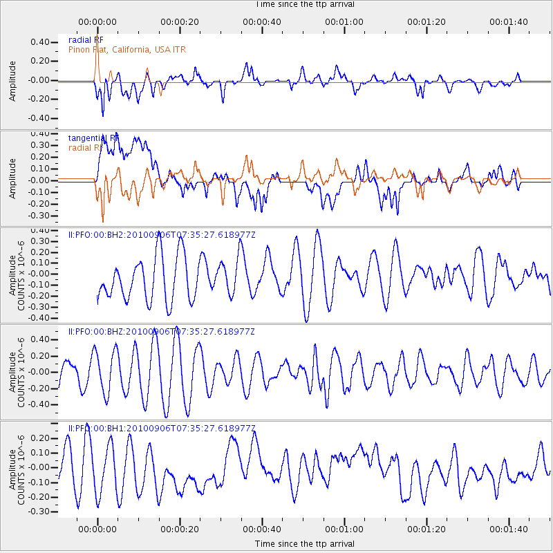
PFO Pinon Flat, California, USA - Earthquake Result Viewer
*The percent match for this event was below the threshold and hence no stack was calculated.
| Earthquake location: |
Tonga Islands |
| Earthquake latitude/longitude: |
-18.3/-175.2 |
| Earthquake time(UTC): |
2010/09/06 (249) 07:24:35 GMT |
| Earthquake Depth: |
222 km |
| Earthquake Magnitude: |
5.5 MW, 5.5 MW, 5.6 MB |
| Earthquake Catalog/Contributor: |
NEIC PDE/NEIC PDE-M |
|
| Network: |
II Global Seismograph Network (GSN - IRIS/IDA) |
| Station: |
PFO Pinon Flat, California, USA |
| Lat/Lon: |
33.61 N/116.46 W |
| Elevation: |
1280 m |
|
| Distance: |
76.2 deg |
| Az: |
47.288 deg |
| Baz: |
236.764 deg |
| Ray Param: |
$rayparam |
*The percent match for this event was below the threshold and hence was not used in the summary stack. |
|
| Radial Match: |
58.687027 % |
| Radial Bump: |
400 |
| Transverse Match: |
31.603207 % |
| Transverse Bump: |
400 |
| SOD ConfigId: |
617450 |
| Insert Time: |
2013-10-01 11:06:14.278 +0000 |
| GWidth: |
2.5 |
| Max Bumps: |
400 |
| Tol: |
0.001 |
|
Signal To Noise
| Channel | StoN | STA | LTA |
| II:PFO:00:BHZ:20100906T07:35:27.618977Z | 1.9859698 | 2.6655675E-7 | 1.3421995E-7 |
| II:PFO:00:BH1:20100906T07:35:27.618977Z | 1.8477986 | 2.272589E-7 | 1.22989E-7 |
| II:PFO:00:BH2:20100906T07:35:27.618977Z | 0.871525 | 1.7183018E-7 | 1.9716036E-7 |
| Arrivals |
| Ps | |
| PpPs | |
| PsPs/PpSs | |


