You are here: Home > Network List > IU - Global Seismograph Network (GSN - IRIS/USGS) Stations List
> Station RSSD Black Hills, South Dakota, USA > Earthquake Result Viewer
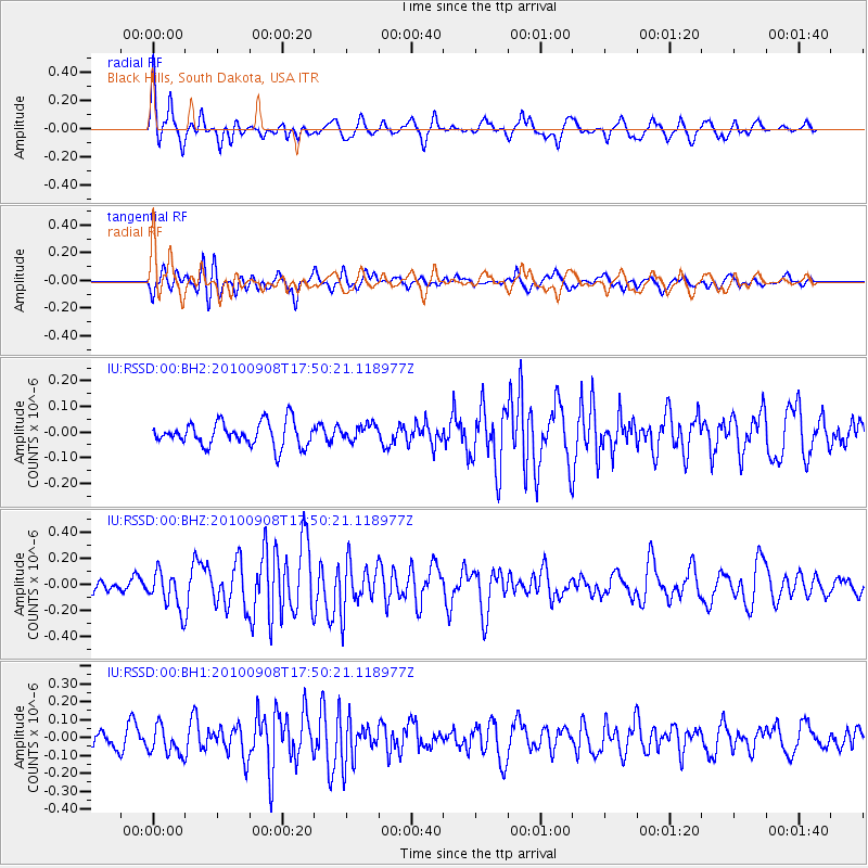
RSSD Black Hills, South Dakota, USA - Earthquake Result Viewer
*The percent match for this event was below the threshold and hence no stack was calculated.
| Earthquake location: |
Kuril Islands |
| Earthquake latitude/longitude: |
44.6/149.7 |
| Earthquake time(UTC): |
2010/09/08 (251) 17:39:40 GMT |
| Earthquake Depth: |
10 km |
| Earthquake Magnitude: |
5.5 MB, 5.3 MS, 5.5 MW |
| Earthquake Catalog/Contributor: |
WHDF/NEIC |
|
| Network: |
IU Global Seismograph Network (GSN - IRIS/USGS) |
| Station: |
RSSD Black Hills, South Dakota, USA |
| Lat/Lon: |
44.12 N/104.04 W |
| Elevation: |
2090 m |
|
| Distance: |
70.0 deg |
| Az: |
47.365 deg |
| Baz: |
313.124 deg |
| Ray Param: |
$rayparam |
*The percent match for this event was below the threshold and hence was not used in the summary stack. |
|
| Radial Match: |
63.926426 % |
| Radial Bump: |
389 |
| Transverse Match: |
64.78167 % |
| Transverse Bump: |
400 |
| SOD ConfigId: |
617450 |
| Insert Time: |
2013-10-01 11:23:28.335 +0000 |
| GWidth: |
2.5 |
| Max Bumps: |
400 |
| Tol: |
0.001 |
|
Signal To Noise
| Channel | StoN | STA | LTA |
| IU:RSSD:00:BHZ:20100908T17:50:21.118977Z | 2.1368713 | 1.4595709E-7 | 6.8304104E-8 |
| IU:RSSD:00:BH1:20100908T17:50:21.118977Z | 0.7997261 | 7.9753065E-8 | 9.9725476E-8 |
| IU:RSSD:00:BH2:20100908T17:50:21.118977Z | 0.6681841 | 3.1060363E-8 | 4.6484736E-8 |
| Arrivals |
| Ps | |
| PpPs | |
| PsPs/PpSs | |


