You are here: Home > Network List > IU - Global Seismograph Network (GSN - IRIS/USGS) Stations List
> Station HNR Honiara, Solomon Islands > Earthquake Result Viewer
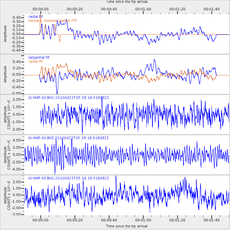
HNR Honiara, Solomon Islands - Earthquake Result Viewer
*The percent match for this event was below the threshold and hence no stack was calculated.
| Earthquake location: |
Rat Islands, Aleutian Islands |
| Earthquake latitude/longitude: |
52.2/179.8 |
| Earthquake time(UTC): |
2010/09/23 (266) 05:28:35 GMT |
| Earthquake Depth: |
168 km |
| Earthquake Magnitude: |
5.6 MW, 5.5 MB, 5.5 MW |
| Earthquake Catalog/Contributor: |
NEIC PDE/NEIC PDE-M |
|
| Network: |
IU Global Seismograph Network (GSN - IRIS/USGS) |
| Station: |
HNR Honiara, Solomon Islands |
| Lat/Lon: |
9.44 S/159.95 E |
| Elevation: |
100 m |
|
| Distance: |
63.7 deg |
| Az: |
201.888 deg |
| Baz: |
13.437 deg |
| Ray Param: |
$rayparam |
*The percent match for this event was below the threshold and hence was not used in the summary stack. |
|
| Radial Match: |
34.235897 % |
| Radial Bump: |
400 |
| Transverse Match: |
44.651684 % |
| Transverse Bump: |
400 |
| SOD ConfigId: |
617450 |
| Insert Time: |
2013-10-01 11:45:24.178 +0000 |
| GWidth: |
2.5 |
| Max Bumps: |
400 |
| Tol: |
0.001 |
|
Signal To Noise
| Channel | StoN | STA | LTA |
| IU:HNR:00:BHZ:20100923T05:38:18.618982Z | 0.9035503 | 1.3010041E-6 | 1.4398801E-6 |
| IU:HNR:00:BH1:20100923T05:38:18.618982Z | 1.1873034 | 1.140822E-6 | 9.608513E-7 |
| IU:HNR:00:BH2:20100923T05:38:18.618982Z | 0.80596536 | 6.076999E-7 | 7.5400254E-7 |
| Arrivals |
| Ps | |
| PpPs | |
| PsPs/PpSs | |


