You are here: Home > Network List > II - Global Seismograph Network (GSN - IRIS/IDA) Stations List
> Station WRAB Tennant Creek, NT, Australia > Earthquake Result Viewer
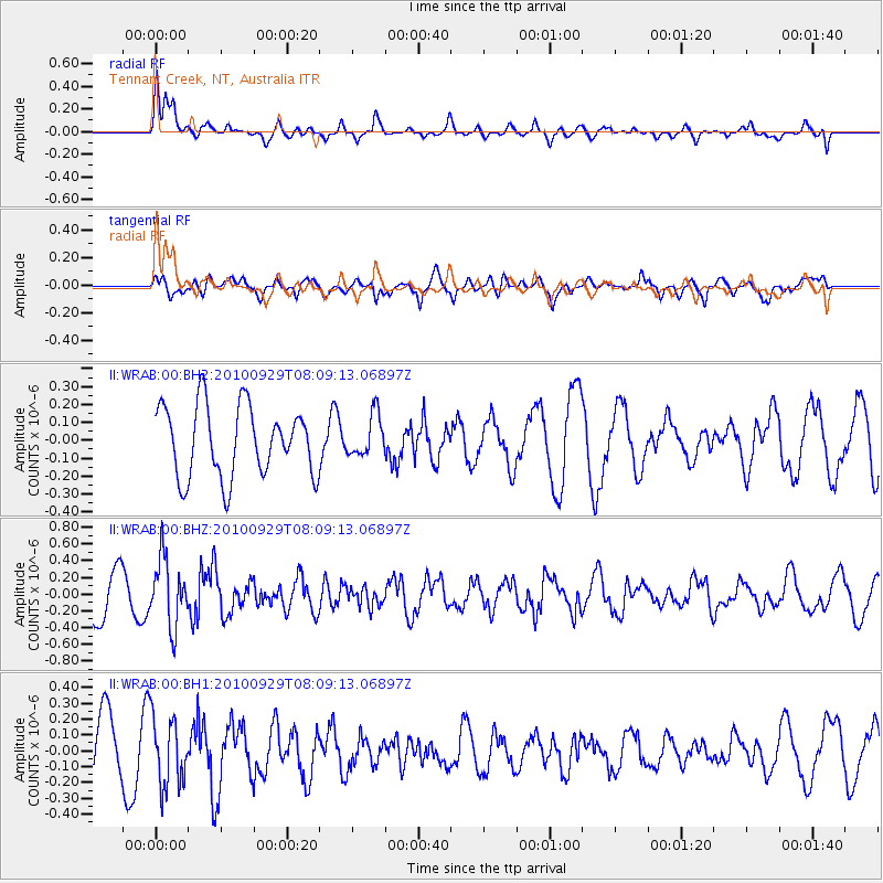
WRAB Tennant Creek, NT, Australia - Earthquake Result Viewer
*The percent match for this event was below the threshold and hence no stack was calculated.
| Earthquake location: |
Eastern Honshu, Japan |
| Earthquake latitude/longitude: |
37.3/139.9 |
| Earthquake time(UTC): |
2010/09/29 (272) 08:00:00 GMT |
| Earthquake Depth: |
33 km |
| Earthquake Magnitude: |
5.5 MW, 5.5 MW, 5.6 MB |
| Earthquake Catalog/Contributor: |
NEIC PDE/NEIC PDE-M |
|
| Network: |
II Global Seismograph Network (GSN - IRIS/IDA) |
| Station: |
WRAB Tennant Creek, NT, Australia |
| Lat/Lon: |
19.93 S/134.36 E |
| Elevation: |
366 m |
|
| Distance: |
57.1 deg |
| Az: |
186.19 deg |
| Baz: |
5.246 deg |
| Ray Param: |
$rayparam |
*The percent match for this event was below the threshold and hence was not used in the summary stack. |
|
| Radial Match: |
72.809326 % |
| Radial Bump: |
400 |
| Transverse Match: |
47.483315 % |
| Transverse Bump: |
400 |
| SOD ConfigId: |
617450 |
| Insert Time: |
2013-10-01 12:02:34.041 +0000 |
| GWidth: |
2.5 |
| Max Bumps: |
400 |
| Tol: |
0.001 |
|
Signal To Noise
| Channel | StoN | STA | LTA |
| II:WRAB:00:BHZ:20100929T08:09:13.06897Z | 1.9329363 | 4.0097228E-7 | 2.0744206E-7 |
| II:WRAB:00:BH1:20100929T08:09:13.06897Z | 1.386471 | 2.157224E-7 | 1.5559098E-7 |
| II:WRAB:00:BH2:20100929T08:09:13.06897Z | 0.58864105 | 1.1611226E-7 | 1.9725478E-7 |
| Arrivals |
| Ps | |
| PpPs | |
| PsPs/PpSs | |


