You are here: Home > Network List > IU - Global Seismograph Network (GSN - IRIS/USGS) Stations List
> Station MAKZ Makanchi, Kazakhstan > Earthquake Result Viewer
MAKZ Makanchi, Kazakhstan - Earthquake Result Viewer
*The percent match for this event was below the threshold and hence no stack was calculated.
| Earthquake location: |
Eastern Honshu, Japan |
| Earthquake latitude/longitude: |
37.3/139.9 |
| Earthquake time(UTC): |
2010/09/29 (272) 08:00:00 GMT |
| Earthquake Depth: |
33 km |
| Earthquake Magnitude: |
5.5 MW, 5.5 MW, 5.6 MB |
| Earthquake Catalog/Contributor: |
NEIC PDE/NEIC PDE-M |
|
| Network: |
IU Global Seismograph Network (GSN - IRIS/USGS) |
| Station: |
MAKZ Makanchi, Kazakhstan |
| Lat/Lon: |
46.81 N/81.98 E |
| Elevation: |
600 m |
|
| Distance: |
43.2 deg |
| Az: |
301.734 deg |
| Baz: |
81.09 deg |
| Ray Param: |
$rayparam |
*The percent match for this event was below the threshold and hence was not used in the summary stack. |
|
| Radial Match: |
71.72311 % |
| Radial Bump: |
400 |
| Transverse Match: |
48.627167 % |
| Transverse Bump: |
376 |
| SOD ConfigId: |
617450 |
| Insert Time: |
2013-10-01 12:02:47.514 +0000 |
| GWidth: |
2.5 |
| Max Bumps: |
400 |
| Tol: |
0.001 |
|
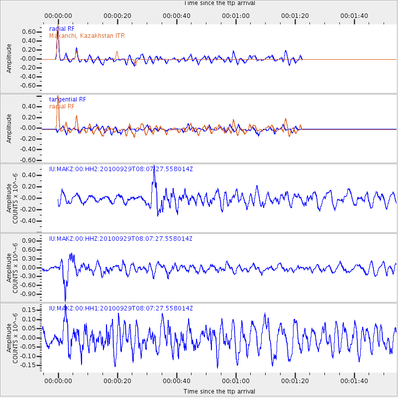
Signal To Noise
| Channel | StoN | STA | LTA |
| IU:MAKZ:00:HHZ:20100929T08:07:27.558014Z | 5.79248 | 4.066022E-7 | 7.0194844E-8 |
| IU:MAKZ:00:HH1:20100929T08:07:27.558014Z | 1.2665262 | 7.353859E-8 | 5.8063215E-8 |
| IU:MAKZ:00:HH2:20100929T08:07:27.558014Z | 3.7568603 | 2.2367296E-7 | 5.9537204E-8 |
| Arrivals |
| Ps | |
| PpPs | |
| PsPs/PpSs | |


