You are here: Home > Network List > II - Global Seismograph Network (GSN - IRIS/IDA) Stations List
> Station AAK Ala Archa, Kyrgyzstan > Earthquake Result Viewer
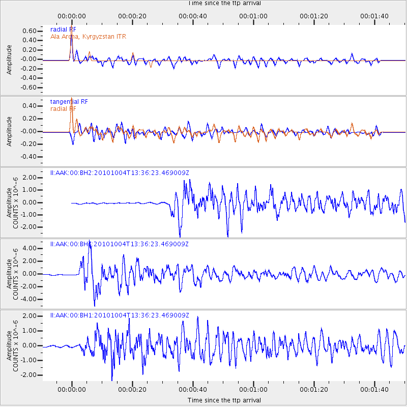
AAK Ala Archa, Kyrgyzstan - Earthquake Result Viewer
*The percent match for this event was below the threshold and hence no stack was calculated.
| Earthquake location: |
Southwestern Ryukyu Isl., Japan |
| Earthquake latitude/longitude: |
24.3/125.2 |
| Earthquake time(UTC): |
2010/10/04 (277) 13:28:38 GMT |
| Earthquake Depth: |
32 km |
| Earthquake Magnitude: |
6.3 MW, 6.0 MS, 6.2 MB, 6.3 MW |
| Earthquake Catalog/Contributor: |
NEIC PDE/NEIC PDE-M |
|
| Network: |
II Global Seismograph Network (GSN - IRIS/IDA) |
| Station: |
AAK Ala Archa, Kyrgyzstan |
| Lat/Lon: |
42.64 N/74.49 E |
| Elevation: |
1645 m |
|
| Distance: |
45.3 deg |
| Az: |
306.66 deg |
| Baz: |
97.175 deg |
| Ray Param: |
$rayparam |
*The percent match for this event was below the threshold and hence was not used in the summary stack. |
|
| Radial Match: |
79.85319 % |
| Radial Bump: |
400 |
| Transverse Match: |
76.66028 % |
| Transverse Bump: |
400 |
| SOD ConfigId: |
617450 |
| Insert Time: |
2013-10-01 12:25:58.341 +0000 |
| GWidth: |
2.5 |
| Max Bumps: |
400 |
| Tol: |
0.001 |
|
Signal To Noise
| Channel | StoN | STA | LTA |
| II:AAK:00:BHZ:20101004T13:36:23.469009Z | 19.224834 | 1.0900371E-6 | 5.669943E-8 |
| II:AAK:00:BH1:20101004T13:36:23.469009Z | 5.0661635 | 1.7500369E-7 | 3.4543632E-8 |
| II:AAK:00:BH2:20101004T13:36:23.469009Z | 16.08168 | 4.923428E-7 | 3.0615134E-8 |
| Arrivals |
| Ps | |
| PpPs | |
| PsPs/PpSs | |


