You are here: Home > Network List > IU - Global Seismograph Network (GSN - IRIS/USGS) Stations List
> Station HNR Honiara, Solomon Islands > Earthquake Result Viewer
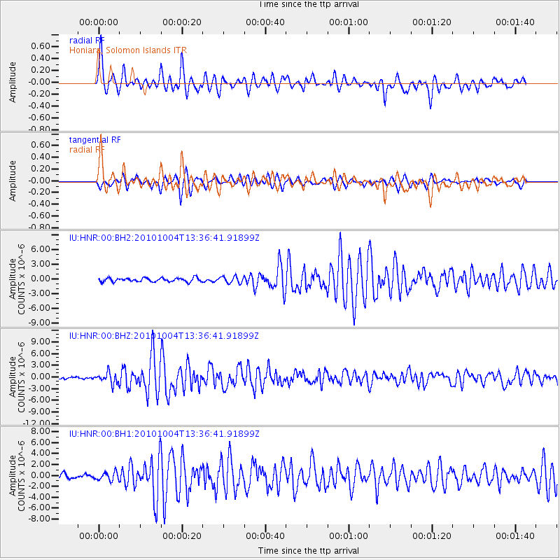
HNR Honiara, Solomon Islands - Earthquake Result Viewer
*The percent match for this event was below the threshold and hence no stack was calculated.
| Earthquake location: |
Southwestern Ryukyu Isl., Japan |
| Earthquake latitude/longitude: |
24.3/125.2 |
| Earthquake time(UTC): |
2010/10/04 (277) 13:28:38 GMT |
| Earthquake Depth: |
32 km |
| Earthquake Magnitude: |
6.3 MW, 6.0 MS, 6.2 MB, 6.3 MW |
| Earthquake Catalog/Contributor: |
NEIC PDE/NEIC PDE-M |
|
| Network: |
IU Global Seismograph Network (GSN - IRIS/USGS) |
| Station: |
HNR Honiara, Solomon Islands |
| Lat/Lon: |
9.44 S/159.95 E |
| Elevation: |
100 m |
|
| Distance: |
47.7 deg |
| Az: |
130.443 deg |
| Baz: |
315.253 deg |
| Ray Param: |
$rayparam |
*The percent match for this event was below the threshold and hence was not used in the summary stack. |
|
| Radial Match: |
78.70624 % |
| Radial Bump: |
400 |
| Transverse Match: |
84.34967 % |
| Transverse Bump: |
400 |
| SOD ConfigId: |
617450 |
| Insert Time: |
2013-10-01 12:26:24.955 +0000 |
| GWidth: |
2.5 |
| Max Bumps: |
400 |
| Tol: |
0.001 |
|
Signal To Noise
| Channel | StoN | STA | LTA |
| IU:HNR:00:BHZ:20101004T13:36:41.91899Z | 4.358864 | 1.4294798E-6 | 3.2794776E-7 |
| IU:HNR:00:BH1:20101004T13:36:41.91899Z | 1.7130357 | 7.4928937E-7 | 4.3740442E-7 |
| IU:HNR:00:BH2:20101004T13:36:41.91899Z | 1.8062862 | 6.823407E-7 | 3.7775894E-7 |
| Arrivals |
| Ps | |
| PpPs | |
| PsPs/PpSs | |


