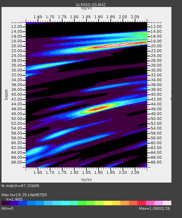
RSSD Black Hills, South Dakota, USA - Earthquake Result Viewer
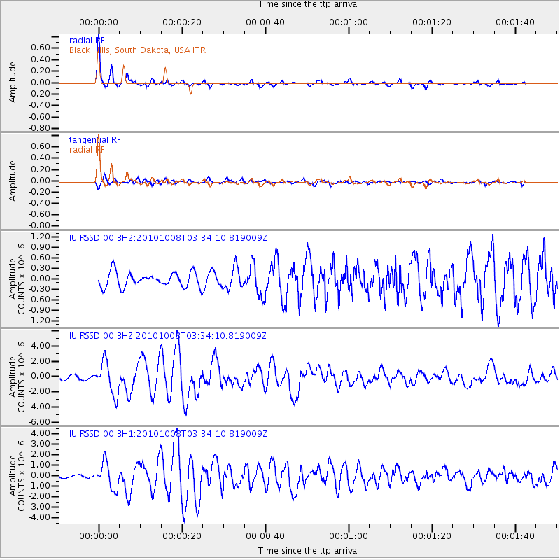
Earthquake location: Andreanof Islands, Aleutian Is.
Earthquake latitude/longitude: 51.4/-175.4
Earthquake time(UTC): 2010/10/08 (281) 03:26:13 GMT
Earthquake Depth: 19 km
Earthquake Magnitude: 6.2 MB, 6.3 MS, 6.4 MW, 6.2 MW
Earthquake Catalog/Contributor: WHDF/NEIC
Network: IU Global Seismograph Network (GSN - IRIS/USGS)
Station: RSSD Black Hills, South Dakota, USA
Lat/Lon: 44.12 N/104.04 W
Elevation: 2090 m
Distance: 46.8 deg
Az: 69.495 deg
Baz: 305.397 deg
Ray Param: 0.070420355
Estimated Moho Depth: 19.25 km
Estimated Crust Vp/Vs: 1.99
Assumed Crust Vp: 6.242 km/s
Estimated Crust Vs: 3.145 km/s
Estimated Crust Poisson's Ratio: 0.33
Radial Match: 97.33609 %
Radial Bump: 306
Transverse Match: 76.7401 %
Transverse Bump: 400
SOD ConfigId: 617450
Insert Time: 2013-10-01 12:33:47.077 +0000
GWidth: 2.5
Max Bumps: 400
Tol: 0.001

Signal To Noise

ChannelStoNSTALTA
IU:RSSD:00:BHZ:20101008T03:34:10.819009Z9.320662.1633518E-62.3210286E-7
IU:RSSD:00:BH1:20101008T03:34:10.819009Z6.83498861.2379456E-61.8111889E-7
IU:RSSD:00:BH2:20101008T03:34:10.819009Z1.44397042.986084E-72.0679677E-7
Arrivals
Ps3.2 SECOND
PpPs8.7 SECOND
PsPs/PpSs12 SECOND