You are here: Home > Network List > II - Global Seismograph Network (GSN - IRIS/IDA) Stations List
> Station WRAB Tennant Creek, NT, Australia > Earthquake Result Viewer
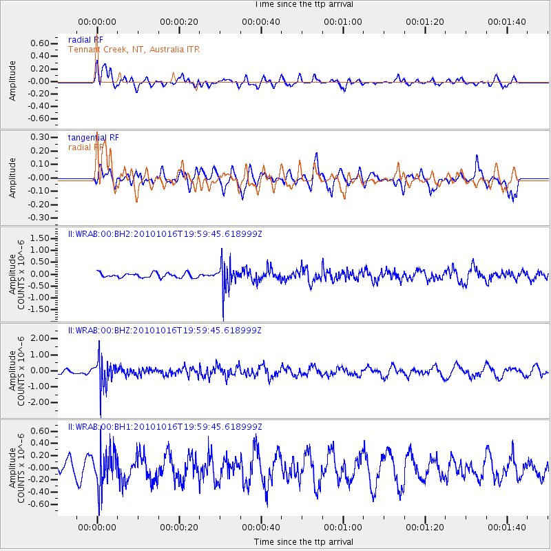
WRAB Tennant Creek, NT, Australia - Earthquake Result Viewer
*The percent match for this event was below the threshold and hence no stack was calculated.
| Earthquake location: |
Nicobar Islands, India Region |
| Earthquake latitude/longitude: |
6.6/94.3 |
| Earthquake time(UTC): |
2010/10/16 (289) 19:51:51 GMT |
| Earthquake Depth: |
94 km |
| Earthquake Magnitude: |
5.7 MB, 5.3 MW, 5.3 MW |
| Earthquake Catalog/Contributor: |
WHDF/NEIC |
|
| Network: |
II Global Seismograph Network (GSN - IRIS/IDA) |
| Station: |
WRAB Tennant Creek, NT, Australia |
| Lat/Lon: |
19.93 S/134.36 E |
| Elevation: |
366 m |
|
| Distance: |
47.4 deg |
| Az: |
124.726 deg |
| Baz: |
299.793 deg |
| Ray Param: |
$rayparam |
*The percent match for this event was below the threshold and hence was not used in the summary stack. |
|
| Radial Match: |
53.766304 % |
| Radial Bump: |
400 |
| Transverse Match: |
62.563683 % |
| Transverse Bump: |
400 |
| SOD ConfigId: |
617450 |
| Insert Time: |
2013-10-01 12:56:42.853 +0000 |
| GWidth: |
2.5 |
| Max Bumps: |
400 |
| Tol: |
0.001 |
|
Signal To Noise
| Channel | StoN | STA | LTA |
| II:WRAB:00:BHZ:20101016T19:59:45.618999Z | 3.7614033 | 8.2424816E-7 | 2.1913316E-7 |
| II:WRAB:00:BH1:20101016T19:59:45.618999Z | 3.1304953 | 3.058741E-7 | 9.77079E-8 |
| II:WRAB:00:BH2:20101016T19:59:45.618999Z | 5.3667717 | 5.2042964E-7 | 9.697256E-8 |
| Arrivals |
| Ps | |
| PpPs | |
| PsPs/PpSs | |


