You are here: Home > Network List > IU - Global Seismograph Network (GSN - IRIS/USGS) Stations List
> Station RSSD Black Hills, South Dakota, USA > Earthquake Result Viewer
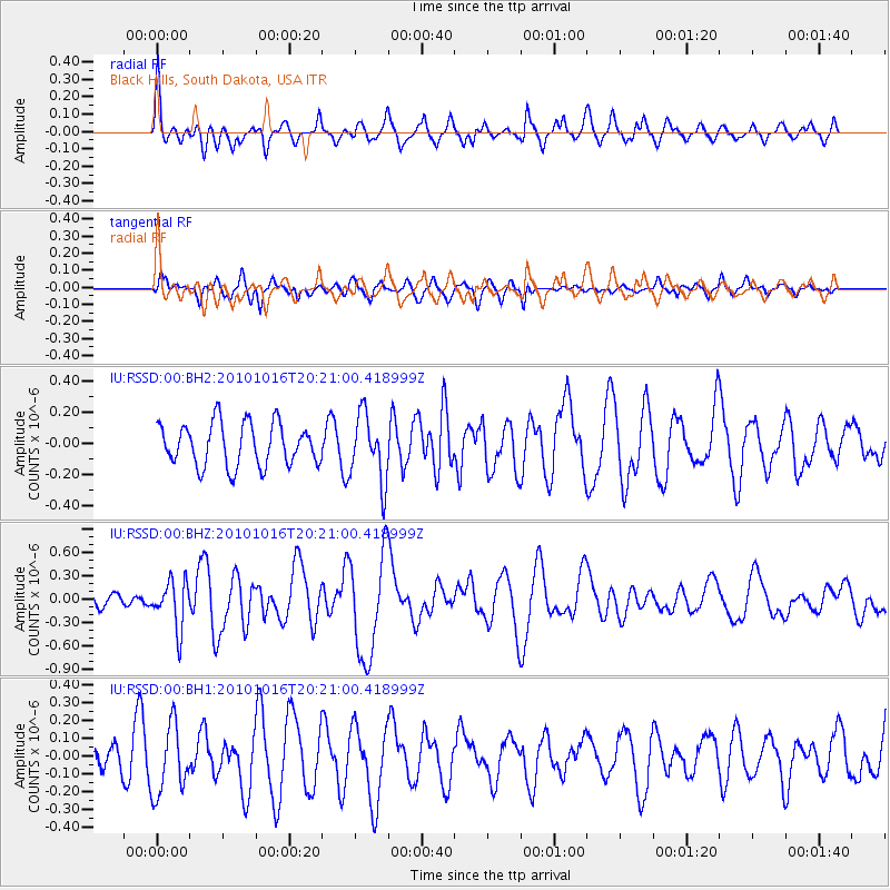
RSSD Black Hills, South Dakota, USA - Earthquake Result Viewer
*The percent match for this event was below the threshold and hence no stack was calculated.
| Earthquake location: |
Tonga Islands |
| Earthquake latitude/longitude: |
-20.4/-173.8 |
| Earthquake time(UTC): |
2010/10/16 (289) 20:08:30 GMT |
| Earthquake Depth: |
8.0 km |
| Earthquake Magnitude: |
6.1 MB, 5.9 MS, 5.9 MW, 5.8 MW |
| Earthquake Catalog/Contributor: |
WHDF/NEIC |
|
| Network: |
IU Global Seismograph Network (GSN - IRIS/USGS) |
| Station: |
RSSD Black Hills, South Dakota, USA |
| Lat/Lon: |
44.12 N/104.04 W |
| Elevation: |
2090 m |
|
| Distance: |
90.4 deg |
| Az: |
42.529 deg |
| Baz: |
241.684 deg |
| Ray Param: |
$rayparam |
*The percent match for this event was below the threshold and hence was not used in the summary stack. |
|
| Radial Match: |
60.657574 % |
| Radial Bump: |
400 |
| Transverse Match: |
54.020756 % |
| Transverse Bump: |
384 |
| SOD ConfigId: |
617450 |
| Insert Time: |
2013-10-01 12:58:53.518 +0000 |
| GWidth: |
2.5 |
| Max Bumps: |
400 |
| Tol: |
0.001 |
|
Signal To Noise
| Channel | StoN | STA | LTA |
| IU:RSSD:00:BHZ:20101016T20:21:00.418999Z | 2.140464 | 3.0358044E-7 | 1.4182928E-7 |
| IU:RSSD:00:BH1:20101016T20:21:00.418999Z | 2.9739323 | 1.9355483E-7 | 6.50838E-8 |
| IU:RSSD:00:BH2:20101016T20:21:00.418999Z | 1.5839351 | 2.1753144E-7 | 1.3733607E-7 |
| Arrivals |
| Ps | |
| PpPs | |
| PsPs/PpSs | |


