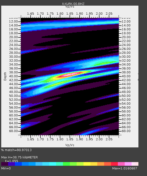
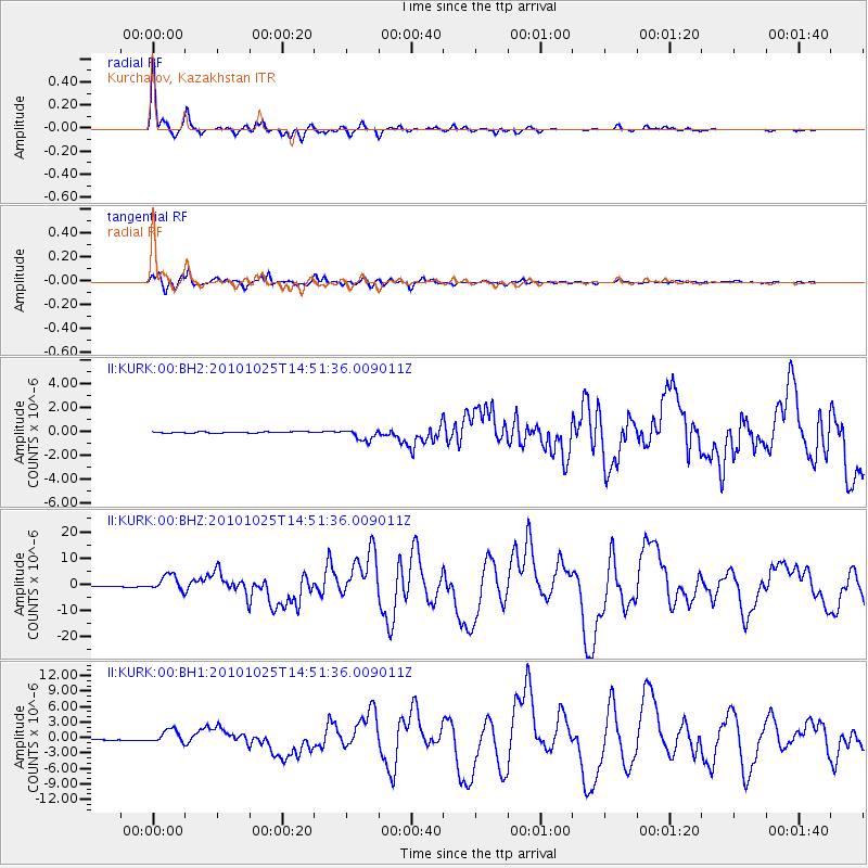
KURK Kurchatov, Kazakhstan - Earthquake Result Viewer

Earthquake location: Southern Sumatra, Indonesia
Earthquake latitude/longitude: -3.5/100.1
Earthquake time(UTC): 2010/10/25 (298) 14:42:22 GMT
Earthquake Depth: 20 km
Earthquake Magnitude: 6.5 MB, 7.3 MS, 7.8 MW, 7.7 MW
Earthquake Catalog/Contributor: WHDF/NEIC
Network: II Global Seismograph Network (GSN - IRIS/IDA)
Station: KURK Kurchatov, Kazakhstan
Lat/Lon: 50.72 N/78.62 E
Elevation: 184 m
Distance: 57.0 deg
Az: 343.908 deg
Baz: 154.2 deg
Ray Param: 0.0637173
Estimated Moho Depth: 38.75 km
Estimated Crust Vp/Vs: 1.86
Assumed Crust Vp: 6.552 km/s
Estimated Crust Vs: 3.532 km/s
Estimated Crust Poisson's Ratio: 0.30
Radial Match: 98.97013 %
Radial Bump: 221
Transverse Match: 97.051834 %
Transverse Bump: 400
SOD ConfigId: 617450
Insert Time: 2013-10-01 13:23:52.815 +0000
GWidth: 2.5
Max Bumps: 400
Tol: 0.001

Signal To Noise

ChannelStoNSTALTA
II:KURK:00:BHZ:20101025T14:51:36.009011Z21.510472.9978394E-61.3936652E-7
II:KURK:00:BH1:20101025T14:51:36.009011Z12.4855421.2959542E-61.03796395E-7
II:KURK:00:BH2:20101025T14:51:36.009011Z9.2400424.832988E-75.2304827E-8
Arrivals
Ps5.3 SECOND
PpPs16 SECOND
PsPs/PpSs21 SECOND