WRAB Tennant Creek, NT, Australia - Earthquake Result Viewer
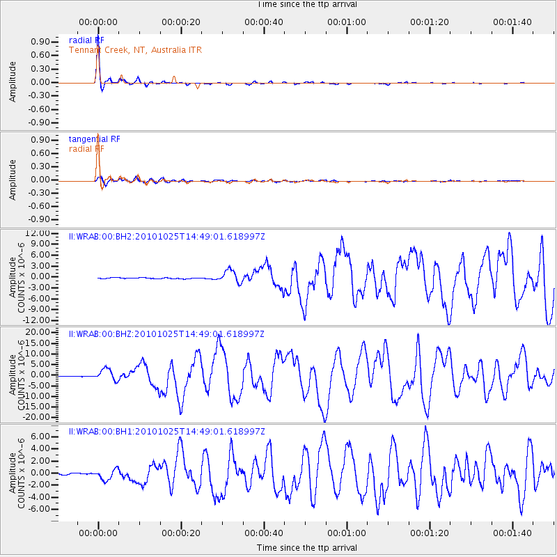
Earthquake location: Southern Sumatra, Indonesia
Earthquake latitude/longitude: -3.5/100.1
Earthquake time(UTC): 2010/10/25 (298) 14:42:22 GMT
Earthquake Depth: 20 km
Earthquake Magnitude: 6.5 MB, 7.3 MS, 7.8 MW, 7.7 MW
Earthquake Catalog/Contributor: WHDF/NEIC
Network: II Global Seismograph Network (GSN - IRIS/IDA)
Station: WRAB Tennant Creek, NT, Australia
Lat/Lon: 19.93 S/134.36 E
Elevation: 366 m
Distance: 37.2 deg
Az: 118.802 deg
Baz: 291.61 deg
Ray Param: 0.07623775
Estimated Moho Depth: 26.5 km
Estimated Crust Vp/Vs: 1.60
Assumed Crust Vp: 6.642 km/s
Estimated Crust Vs: 4.151 km/s
Estimated Crust Poisson's Ratio: 0.18
Radial Match: 98.88258 %
Radial Bump: 193
Transverse Match: 94.46512 %
Transverse Bump: 400
SOD ConfigId: 617450
Insert Time: 2013-10-01 13:24:00.768 +0000
GWidth: 2.5
Max Bumps: 400
Tol: 0.001

Signal To Noise

ChannelStoNSTALTA
II:WRAB:00:BHZ:20101025T14:49:01.618997Z23.3990882.7957178E-61.1947978E-7
II:WRAB:00:BH1:20101025T14:49:01.618997Z6.93507158.9528095E-71.290947E-7
II:WRAB:00:BH2:20101025T14:49:01.618997Z14.0853221.782683E-61.2656317E-7
Arrivals
Ps2.6 SECOND
PpPs9.5 SECOND
PsPs/PpSs12 SECOND