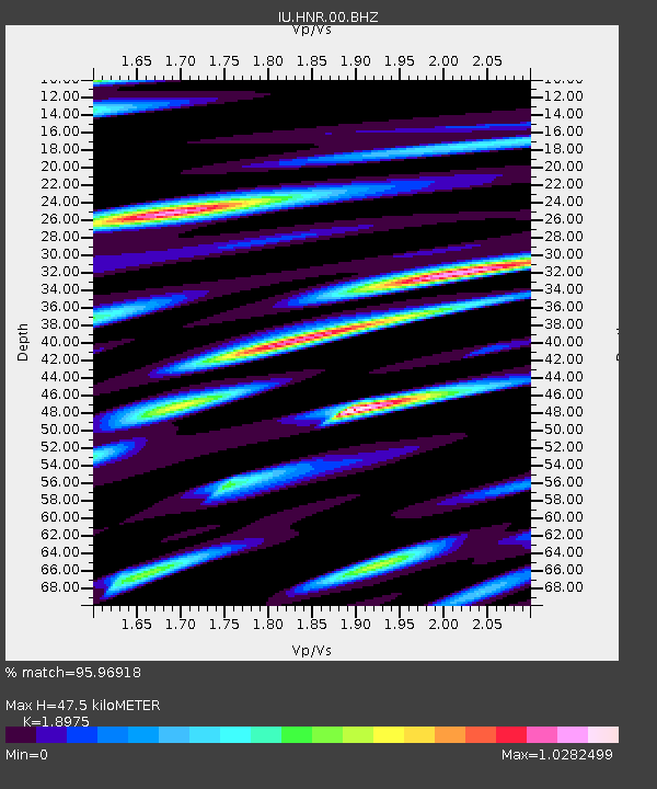
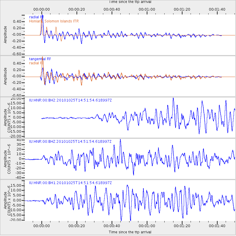
HNR Honiara, Solomon Islands - Earthquake Result Viewer

Earthquake location: Southern Sumatra, Indonesia
Earthquake latitude/longitude: -3.5/100.1
Earthquake time(UTC): 2010/10/25 (298) 14:42:22 GMT
Earthquake Depth: 20 km
Earthquake Magnitude: 6.5 MB, 7.3 MS, 7.8 MW, 7.7 MW
Earthquake Catalog/Contributor: WHDF/NEIC
Network: IU Global Seismograph Network (GSN - IRIS/USGS)
Station: HNR Honiara, Solomon Islands
Lat/Lon: 9.44 S/159.95 E
Elevation: 100 m
Distance: 59.7 deg
Az: 98.84 deg
Baz: 271.462 deg
Ray Param: 0.06198141
Estimated Moho Depth: 47.5 km
Estimated Crust Vp/Vs: 1.90
Assumed Crust Vp: 6.183 km/s
Estimated Crust Vs: 3.258 km/s
Estimated Crust Poisson's Ratio: 0.31
Radial Match: 95.96918 %
Radial Bump: 311
Transverse Match: 96.897354 %
Transverse Bump: 327
SOD ConfigId: 617450
Insert Time: 2013-10-01 13:24:05.440 +0000
GWidth: 2.5
Max Bumps: 400
Tol: 0.001

Signal To Noise

ChannelStoNSTALTA
IU:HNR:00:BHZ:20101025T14:51:54.618997Z15.5173784.3698647E-62.8161102E-7
IU:HNR:00:BH1:20101025T14:51:54.618997Z7.5428111.5130429E-62.0059404E-7
IU:HNR:00:BH2:20101025T14:51:54.618997Z5.56225631.7424599E-63.1326496E-7
Arrivals
Ps7.2 SECOND
PpPs21 SECOND
PsPs/PpSs29 SECOND