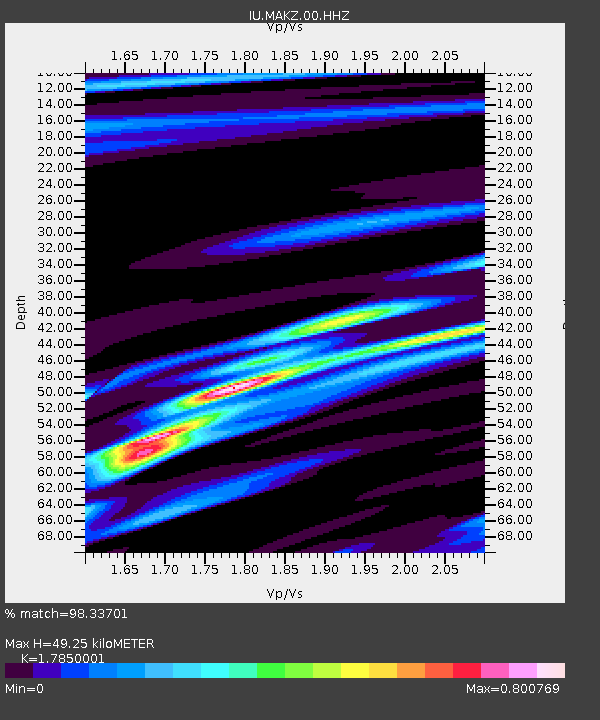
MAKZ Makanchi, Kazakhstan - Earthquake Result Viewer
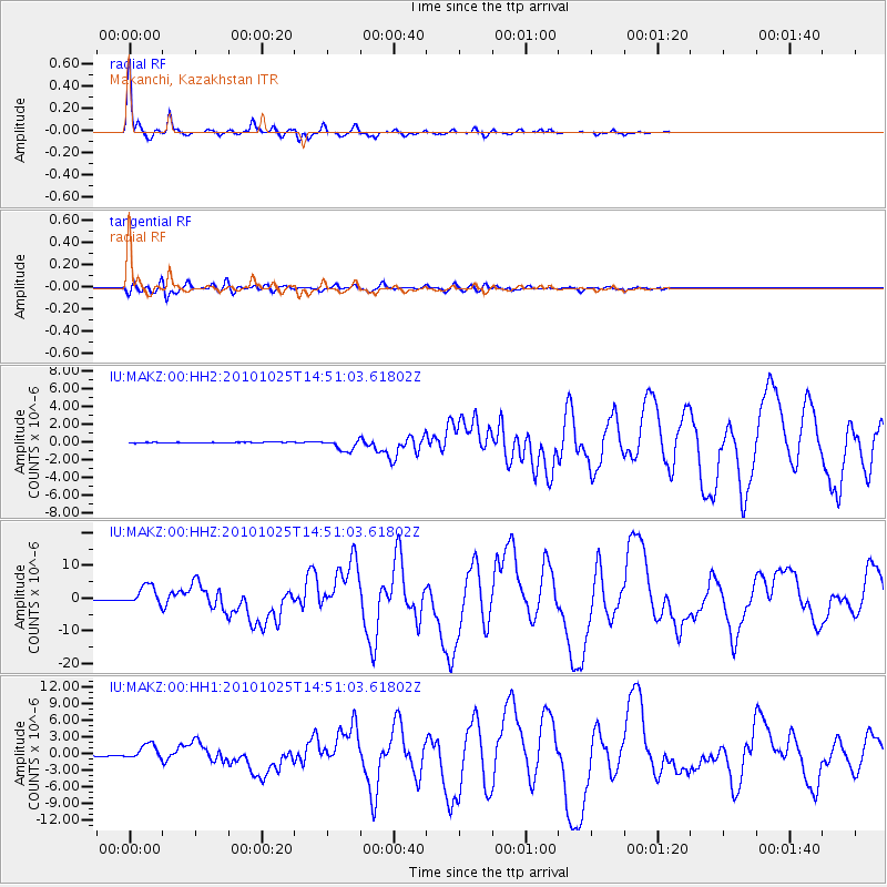
Earthquake location: Southern Sumatra, Indonesia
Earthquake latitude/longitude: -3.5/100.1
Earthquake time(UTC): 2010/10/25 (298) 14:42:22 GMT
Earthquake Depth: 20 km
Earthquake Magnitude: 6.5 MB, 7.3 MS, 7.8 MW, 7.7 MW
Earthquake Catalog/Contributor: WHDF/NEIC
Network: IU Global Seismograph Network (GSN - IRIS/USGS)
Station: MAKZ Makanchi, Kazakhstan
Lat/Lon: 46.81 N/81.98 E
Elevation: 600 m
Distance: 52.6 deg
Az: 344.407 deg
Baz: 157.007 deg
Ray Param: 0.066649765
Estimated Moho Depth: 49.25 km
Estimated Crust Vp/Vs: 1.79
Assumed Crust Vp: 6.571 km/s
Estimated Crust Vs: 3.681 km/s
Estimated Crust Poisson's Ratio: 0.27
Radial Match: 98.33701 %
Radial Bump: 212
Transverse Match: 90.732376 %
Transverse Bump: 400
SOD ConfigId: 617450
Insert Time: 2013-10-01 13:24:09.079 +0000
GWidth: 2.5
Max Bumps: 400
Tol: 0.001

Signal To Noise

ChannelStoNSTALTA
IU:MAKZ:00:HHZ:20101025T14:51:03.61802Z22.529833.0028577E-61.3328363E-7
IU:MAKZ:00:HH1:20101025T14:51:03.61802Z27.5129551.3792605E-65.0131312E-8
IU:MAKZ:00:HH2:20101025T14:51:03.61802Z16.1496876.5668024E-74.06621E-8
Arrivals
Ps6.2 SECOND
PpPs20 SECOND
PsPs/PpSs26 SECOND