You are here: Home > Network List > IU - Global Seismograph Network (GSN - IRIS/USGS) Stations List
> Station MAKZ Makanchi, Kazakhstan > Earthquake Result Viewer
MAKZ Makanchi, Kazakhstan - Earthquake Result Viewer
*The percent match for this event was below the threshold and hence no stack was calculated.
| Earthquake location: |
Southwest Of Sumatra, Indonesia |
| Earthquake latitude/longitude: |
-3.7/99.7 |
| Earthquake time(UTC): |
2010/10/26 (299) 10:51:23 GMT |
| Earthquake Depth: |
10 km |
| Earthquake Magnitude: |
5.5 MB |
| Earthquake Catalog/Contributor: |
NEIC PDE/NEIC PDE-M |
|
| Network: |
IU Global Seismograph Network (GSN - IRIS/USGS) |
| Station: |
MAKZ Makanchi, Kazakhstan |
| Lat/Lon: |
46.81 N/81.98 E |
| Elevation: |
600 m |
|
| Distance: |
52.7 deg |
| Az: |
344.715 deg |
| Baz: |
157.48 deg |
| Ray Param: |
$rayparam |
*The percent match for this event was below the threshold and hence was not used in the summary stack. |
|
| Radial Match: |
52.605373 % |
| Radial Bump: |
400 |
| Transverse Match: |
70.58294 % |
| Transverse Bump: |
400 |
| SOD ConfigId: |
617450 |
| Insert Time: |
2013-10-01 13:34:56.012 +0000 |
| GWidth: |
2.5 |
| Max Bumps: |
400 |
| Tol: |
0.001 |
|
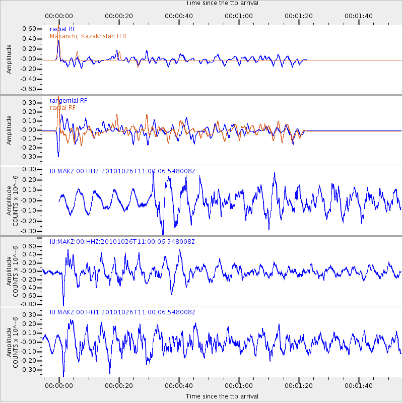
Signal To Noise
| Channel | StoN | STA | LTA |
| IU:MAKZ:00:HHZ:20101026T11:00:06.548008Z | 3.967787 | 2.8032068E-7 | 7.064912E-8 |
| IU:MAKZ:00:HH1:20101026T11:00:06.548008Z | 1.9574273 | 1.57476E-7 | 8.04505E-8 |
| IU:MAKZ:00:HH2:20101026T11:00:06.548008Z | 1.9696795 | 1.391135E-7 | 7.062748E-8 |
| Arrivals |
| Ps | |
| PpPs | |
| PsPs/PpSs | |


