You are here: Home > Network List > II - Global Seismograph Network (GSN - IRIS/IDA) Stations List
> Station AAK Ala Archa, Kyrgyzstan > Earthquake Result Viewer
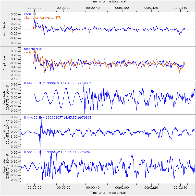
AAK Ala Archa, Kyrgyzstan - Earthquake Result Viewer
*The percent match for this event was below the threshold and hence no stack was calculated.
| Earthquake location: |
Northwest Of Kuril Islands |
| Earthquake latitude/longitude: |
47.5/147.2 |
| Earthquake time(UTC): |
1999/02/05 (036) 14:37:53 GMT |
| Earthquake Depth: |
407 km |
| Earthquake Magnitude: |
6.0 MW, 5.4 MB, 5.8 MW |
| Earthquake Catalog/Contributor: |
WHDF/NEIC |
|
| Network: |
II Global Seismograph Network (GSN - IRIS/IDA) |
| Station: |
AAK Ala Archa, Kyrgyzstan |
| Lat/Lon: |
42.64 N/74.49 E |
| Elevation: |
1645 m |
|
| Distance: |
49.8 deg |
| Az: |
292.791 deg |
| Baz: |
57.895 deg |
| Ray Param: |
$rayparam |
*The percent match for this event was below the threshold and hence was not used in the summary stack. |
|
| Radial Match: |
67.62072 % |
| Radial Bump: |
400 |
| Transverse Match: |
58.51914 % |
| Transverse Bump: |
400 |
| SOD ConfigId: |
4480 |
| Insert Time: |
2010-03-01 15:43:24.561 +0000 |
| GWidth: |
2.5 |
| Max Bumps: |
400 |
| Tol: |
0.001 |
|
Signal To Noise
| Channel | StoN | STA | LTA |
| II:AAK:00:BHN:19990205T14:45:35.997986Z | 4.0904408 | 1.1457315E-6 | 2.8009975E-7 |
| II:AAK:00:BHE:19990205T14:45:35.997986Z | 1.1779474 | 3.2527015E-7 | 2.76133E-7 |
| II:AAK:00:BHZ:19990205T14:45:35.997986Z | 1.3089088 | 4.507639E-7 | 3.4438145E-7 |
| Arrivals |
| Ps | |
| PpPs | |
| PsPs/PpSs | |


