You are here: Home > Network List > II - Global Seismograph Network (GSN - IRIS/IDA) Stations List
> Station WRAB Tennant Creek, NT, Australia > Earthquake Result Viewer
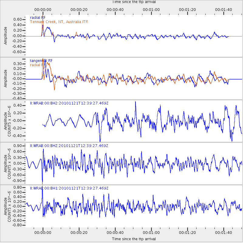
WRAB Tennant Creek, NT, Australia - Earthquake Result Viewer
*The percent match for this event was below the threshold and hence no stack was calculated.
| Earthquake location: |
Taiwan |
| Earthquake latitude/longitude: |
23.8/121.7 |
| Earthquake time(UTC): |
2010/11/21 (325) 12:31:45 GMT |
| Earthquake Depth: |
47 km |
| Earthquake Magnitude: |
5.6 MB, 5.1 MS, 5.6 MW, 5.5 MW |
| Earthquake Catalog/Contributor: |
WHDF/NEIC |
|
| Network: |
II Global Seismograph Network (GSN - IRIS/IDA) |
| Station: |
WRAB Tennant Creek, NT, Australia |
| Lat/Lon: |
19.93 S/134.36 E |
| Elevation: |
366 m |
|
| Distance: |
45.2 deg |
| Az: |
163.057 deg |
| Baz: |
343.521 deg |
| Ray Param: |
$rayparam |
*The percent match for this event was below the threshold and hence was not used in the summary stack. |
|
| Radial Match: |
57.627533 % |
| Radial Bump: |
400 |
| Transverse Match: |
56.851574 % |
| Transverse Bump: |
400 |
| SOD ConfigId: |
617450 |
| Insert Time: |
2013-10-01 14:39:01.285 +0000 |
| GWidth: |
2.5 |
| Max Bumps: |
400 |
| Tol: |
0.001 |
|
Signal To Noise
| Channel | StoN | STA | LTA |
| II:WRAB:00:BHZ:20101121T12:39:27.469Z | 2.401553 | 3.5005823E-7 | 1.4576328E-7 |
| II:WRAB:00:BH1:20101121T12:39:27.469Z | 2.1352804 | 2.6218865E-7 | 1.2278886E-7 |
| II:WRAB:00:BH2:20101121T12:39:27.469Z | 2.6376438 | 2.2766709E-7 | 8.631457E-8 |
| Arrivals |
| Ps | |
| PpPs | |
| PsPs/PpSs | |


