You are here: Home > Network List > IU - Global Seismograph Network (GSN - IRIS/USGS) Stations List
> Station HNR Honiara, Solomon Islands > Earthquake Result Viewer
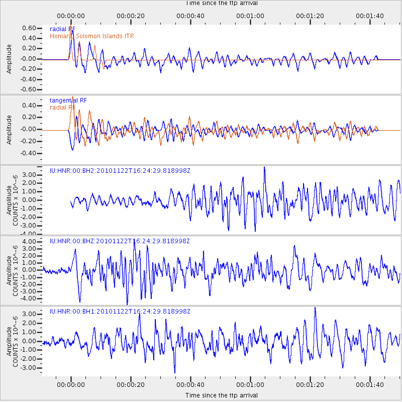
HNR Honiara, Solomon Islands - Earthquake Result Viewer
*The percent match for this event was below the threshold and hence no stack was calculated.
| Earthquake location: |
South Of Kermadec Islands |
| Earthquake latitude/longitude: |
-33.6/-178.9 |
| Earthquake time(UTC): |
2010/11/22 (326) 16:18:43 GMT |
| Earthquake Depth: |
10 km |
| Earthquake Magnitude: |
5.9 MW, 5.6 MB, 5.9 MW, 5.9 MS |
| Earthquake Catalog/Contributor: |
NEIC PDE/NEIC PDE-M |
|
| Network: |
IU Global Seismograph Network (GSN - IRIS/USGS) |
| Station: |
HNR Honiara, Solomon Islands |
| Lat/Lon: |
9.44 S/159.95 E |
| Elevation: |
100 m |
|
| Distance: |
30.9 deg |
| Az: |
316.225 deg |
| Baz: |
144.192 deg |
| Ray Param: |
$rayparam |
*The percent match for this event was below the threshold and hence was not used in the summary stack. |
|
| Radial Match: |
77.34654 % |
| Radial Bump: |
400 |
| Transverse Match: |
73.58172 % |
| Transverse Bump: |
400 |
| SOD ConfigId: |
617450 |
| Insert Time: |
2013-10-01 14:41:14.166 +0000 |
| GWidth: |
2.5 |
| Max Bumps: |
400 |
| Tol: |
0.001 |
|
Signal To Noise
| Channel | StoN | STA | LTA |
| IU:HNR:00:BHZ:20101122T16:24:29.818998Z | 6.343954 | 1.868693E-6 | 2.9456282E-7 |
| IU:HNR:00:BH1:20101122T16:24:29.818998Z | 1.4802512 | 5.192206E-7 | 3.507652E-7 |
| IU:HNR:00:BH2:20101122T16:24:29.818998Z | 1.6248252 | 6.471208E-7 | 3.9827106E-7 |
| Arrivals |
| Ps | |
| PpPs | |
| PsPs/PpSs | |


