You are here: Home > Network List > II - Global Seismograph Network (GSN - IRIS/IDA) Stations List
> Station AAK Ala Archa, Kyrgyzstan > Earthquake Result Viewer
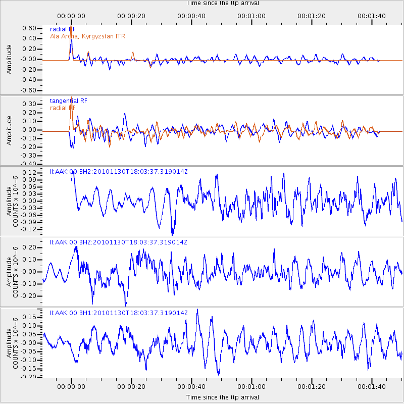
AAK Ala Archa, Kyrgyzstan - Earthquake Result Viewer
*The percent match for this event was below the threshold and hence no stack was calculated.
| Earthquake location: |
Kuril Islands |
| Earthquake latitude/longitude: |
48.9/154.9 |
| Earthquake time(UTC): |
2010/11/30 (334) 17:54:47 GMT |
| Earthquake Depth: |
35 km |
| Earthquake Magnitude: |
5.7 MW, 5.2 MS, 5.4 MB, 5.6 MW |
| Earthquake Catalog/Contributor: |
WHDF/NEIC |
|
| Network: |
II Global Seismograph Network (GSN - IRIS/IDA) |
| Station: |
AAK Ala Archa, Kyrgyzstan |
| Lat/Lon: |
42.64 N/74.49 E |
| Elevation: |
1645 m |
|
| Distance: |
54.0 deg |
| Az: |
295.874 deg |
| Baz: |
53.54 deg |
| Ray Param: |
$rayparam |
*The percent match for this event was below the threshold and hence was not used in the summary stack. |
|
| Radial Match: |
63.77709 % |
| Radial Bump: |
400 |
| Transverse Match: |
59.89429 % |
| Transverse Bump: |
400 |
| SOD ConfigId: |
617450 |
| Insert Time: |
2013-10-01 14:59:19.796 +0000 |
| GWidth: |
2.5 |
| Max Bumps: |
400 |
| Tol: |
0.001 |
|
Signal To Noise
| Channel | StoN | STA | LTA |
| II:AAK:00:BHZ:20101130T18:03:37.319014Z | 2.8303583 | 1.1144818E-7 | 3.9375994E-8 |
| II:AAK:00:BH1:20101130T18:03:37.319014Z | 1.1748037 | 5.3595592E-8 | 4.562089E-8 |
| II:AAK:00:BH2:20101130T18:03:37.319014Z | 2.188518 | 7.920438E-8 | 3.6190873E-8 |
| Arrivals |
| Ps | |
| PpPs | |
| PsPs/PpSs | |


