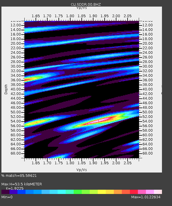
SDDR Presa de Sabaneta, Dominican Republic - Earthquake Result Viewer

Earthquake location: South Sandwich Islands Region
Earthquake latitude/longitude: -56.4/-25.7
Earthquake time(UTC): 2010/12/08 (342) 05:24:35 GMT
Earthquake Depth: 29 km
Earthquake Magnitude: 6.1 MB, 6.2 MS, 6.3 MW, 6.3 MW
Earthquake Catalog/Contributor: WHDF/NEIC
Network: CU Caribbean Network (USGS)
Station: SDDR Presa de Sabaneta, Dominican Republic
Lat/Lon: 18.98 N/71.29 W
Elevation: 589 m
Distance: 84.3 deg
Az: 317.246 deg
Baz: 156.502 deg
Ray Param: 0.04555503
Estimated Moho Depth: 53.5 km
Estimated Crust Vp/Vs: 1.92
Assumed Crust Vp: 6.448 km/s
Estimated Crust Vs: 3.354 km/s
Estimated Crust Poisson's Ratio: 0.31
Radial Match: 85.59621 %
Radial Bump: 400
Transverse Match: 73.265945 %
Transverse Bump: 400
SOD ConfigId: 617450
Insert Time: 2013-10-01 15:20:06.868 +0000
GWidth: 2.5
Max Bumps: 400
Tol: 0.001

Signal To Noise

ChannelStoNSTALTA
CU:SDDR:00:BHZ:20101208T05:36:32.950002Z7.8445791.8973797E-62.4187145E-7
CU:SDDR:00:BH1:20101208T05:36:32.950002Z2.26970466.485053E-72.8572236E-7
CU:SDDR:00:BH2:20101208T05:36:32.950002Z1.70217033.3587293E-71.973204E-7
Arrivals
Ps7.8 SECOND
PpPs24 SECOND
PsPs/PpSs32 SECOND