You are here: Home > Network List > II - Global Seismograph Network (GSN - IRIS/IDA) Stations List
> Station WRAB Tennant Creek, NT, Australia > Earthquake Result Viewer
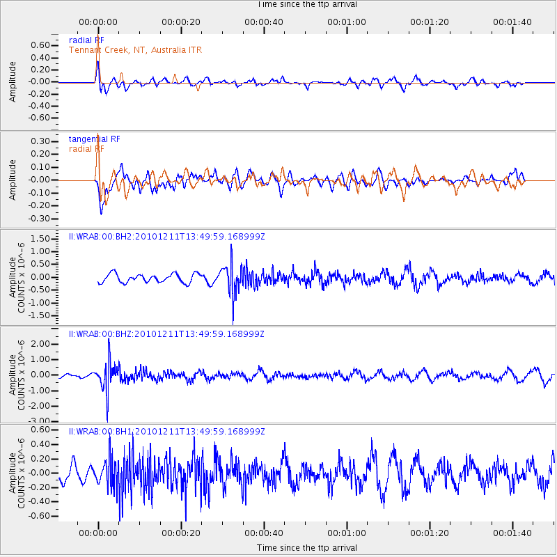
WRAB Tennant Creek, NT, Australia - Earthquake Result Viewer
*The percent match for this event was below the threshold and hence no stack was calculated.
| Earthquake location: |
Fiji Islands Region |
| Earthquake latitude/longitude: |
-21.8/-179.4 |
| Earthquake time(UTC): |
2010/12/11 (345) 13:43:20 GMT |
| Earthquake Depth: |
601 km |
| Earthquake Magnitude: |
5.6 MW, 5.1 MB, 5.5 MW |
| Earthquake Catalog/Contributor: |
WHDF/NEIC |
|
| Network: |
II Global Seismograph Network (GSN - IRIS/IDA) |
| Station: |
WRAB Tennant Creek, NT, Australia |
| Lat/Lon: |
19.93 S/134.36 E |
| Elevation: |
366 m |
|
| Distance: |
43.2 deg |
| Az: |
263.725 deg |
| Baz: |
100.945 deg |
| Ray Param: |
$rayparam |
*The percent match for this event was below the threshold and hence was not used in the summary stack. |
|
| Radial Match: |
65.132706 % |
| Radial Bump: |
400 |
| Transverse Match: |
70.032166 % |
| Transverse Bump: |
400 |
| SOD ConfigId: |
617450 |
| Insert Time: |
2013-10-01 15:31:14.608 +0000 |
| GWidth: |
2.5 |
| Max Bumps: |
400 |
| Tol: |
0.001 |
|
Signal To Noise
| Channel | StoN | STA | LTA |
| II:WRAB:00:BHZ:20101211T13:49:59.168999Z | 3.2094247 | 9.4779796E-7 | 2.9531708E-7 |
| II:WRAB:00:BH1:20101211T13:49:59.168999Z | 1.0634651 | 1.8349365E-7 | 1.7254318E-7 |
| II:WRAB:00:BH2:20101211T13:49:59.168999Z | 3.414601 | 5.756601E-7 | 1.6858782E-7 |
| Arrivals |
| Ps | |
| PpPs | |
| PsPs/PpSs | |


