You are here: Home > Network List > IU - Global Seismograph Network (GSN - IRIS/USGS) Stations List
> Station HNR Honiara, Solomon Islands > Earthquake Result Viewer
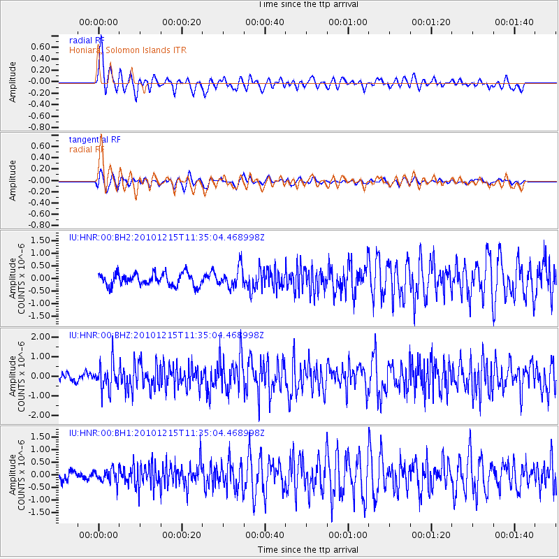
HNR Honiara, Solomon Islands - Earthquake Result Viewer
*The percent match for this event was below the threshold and hence no stack was calculated.
| Earthquake location: |
Banda Sea |
| Earthquake latitude/longitude: |
-7.3/128.8 |
| Earthquake time(UTC): |
2010/12/15 (349) 11:29:30 GMT |
| Earthquake Depth: |
135 km |
| Earthquake Magnitude: |
6.0 MW, 5.8 MB, 5.9 MW |
| Earthquake Catalog/Contributor: |
NEIC PDE/NEIC PDE-M |
|
| Network: |
IU Global Seismograph Network (GSN - IRIS/USGS) |
| Station: |
HNR Honiara, Solomon Islands |
| Lat/Lon: |
9.44 S/159.95 E |
| Elevation: |
100 m |
|
| Distance: |
30.9 deg |
| Az: |
96.207 deg |
| Baz: |
271.597 deg |
| Ray Param: |
$rayparam |
*The percent match for this event was below the threshold and hence was not used in the summary stack. |
|
| Radial Match: |
79.2186 % |
| Radial Bump: |
400 |
| Transverse Match: |
66.722015 % |
| Transverse Bump: |
400 |
| SOD ConfigId: |
617450 |
| Insert Time: |
2013-10-01 15:38:34.628 +0000 |
| GWidth: |
2.5 |
| Max Bumps: |
400 |
| Tol: |
0.001 |
|
Signal To Noise
| Channel | StoN | STA | LTA |
| IU:HNR:00:BHZ:20101215T11:35:04.468998Z | 3.9037564 | 6.795429E-7 | 1.740741E-7 |
| IU:HNR:00:BH1:20101215T11:35:04.468998Z | 1.31255 | 2.6985407E-7 | 2.0559528E-7 |
| IU:HNR:00:BH2:20101215T11:35:04.468998Z | 1.66671 | 4.0388738E-7 | 2.423261E-7 |
| Arrivals |
| Ps | |
| PpPs | |
| PsPs/PpSs | |


