You are here: Home > Network List > II - Global Seismograph Network (GSN - IRIS/IDA) Stations List
> Station PFO Pinon Flat, California, USA > Earthquake Result Viewer
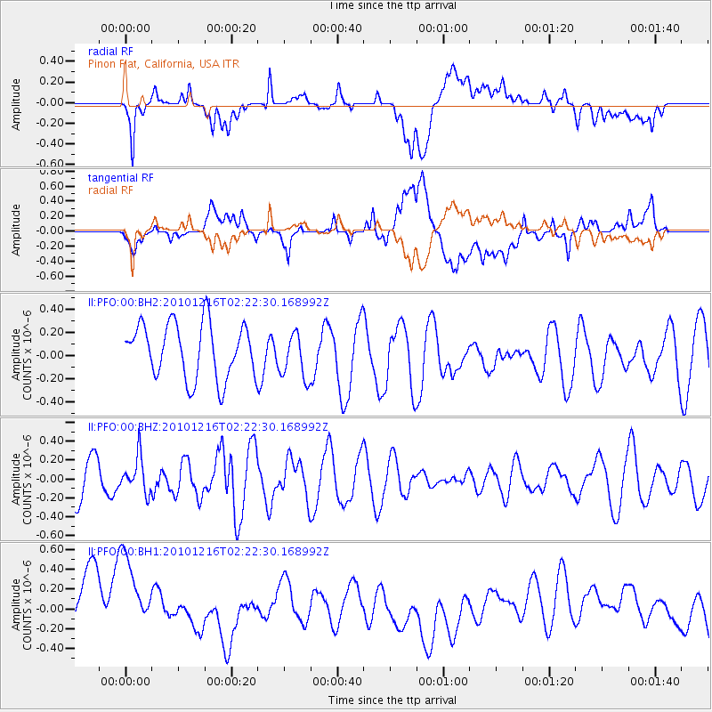
PFO Pinon Flat, California, USA - Earthquake Result Viewer
*The percent match for this event was below the threshold and hence no stack was calculated.
| Earthquake location: |
Kermadec Islands, New Zealand |
| Earthquake latitude/longitude: |
-30.4/-178.0 |
| Earthquake time(UTC): |
2010/12/16 (350) 02:10:23 GMT |
| Earthquake Depth: |
36 km |
| Earthquake Magnitude: |
5.5 MB |
| Earthquake Catalog/Contributor: |
NEIC PDE/NEIC PDE-M |
|
| Network: |
II Global Seismograph Network (GSN - IRIS/IDA) |
| Station: |
PFO Pinon Flat, California, USA |
| Lat/Lon: |
33.61 N/116.46 W |
| Elevation: |
1280 m |
|
| Distance: |
86.2 deg |
| Az: |
47.348 deg |
| Baz: |
229.617 deg |
| Ray Param: |
$rayparam |
*The percent match for this event was below the threshold and hence was not used in the summary stack. |
|
| Radial Match: |
39.9592 % |
| Radial Bump: |
400 |
| Transverse Match: |
35.613857 % |
| Transverse Bump: |
400 |
| SOD ConfigId: |
617450 |
| Insert Time: |
2013-10-01 15:39:52.025 +0000 |
| GWidth: |
2.5 |
| Max Bumps: |
400 |
| Tol: |
0.001 |
|
Signal To Noise
| Channel | StoN | STA | LTA |
| II:PFO:00:BHZ:20101216T02:22:30.168992Z | 0.63880897 | 1.9116888E-7 | 2.992583E-7 |
| II:PFO:00:BH1:20101216T02:22:30.168992Z | 1.017584 | 7.134932E-7 | 7.0116397E-7 |
| II:PFO:00:BH2:20101216T02:22:30.168992Z | 0.84517866 | 1.9952358E-7 | 2.3607267E-7 |
| Arrivals |
| Ps | |
| PpPs | |
| PsPs/PpSs | |


