You are here: Home > Network List > IU - Global Seismograph Network (GSN - IRIS/USGS) Stations List
> Station HNR Honiara, Solomon Islands > Earthquake Result Viewer
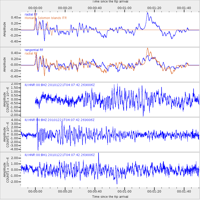
HNR Honiara, Solomon Islands - Earthquake Result Viewer
*The percent match for this event was below the threshold and hence no stack was calculated.
| Earthquake location: |
Java, Indonesia |
| Earthquake latitude/longitude: |
-8.7/111.2 |
| Earthquake time(UTC): |
2010/12/21 (355) 03:59:38 GMT |
| Earthquake Depth: |
55 km |
| Earthquake Magnitude: |
5.7 MB, 5.6 MW, 5.5 MW |
| Earthquake Catalog/Contributor: |
WHDF/NEIC |
|
| Network: |
IU Global Seismograph Network (GSN - IRIS/USGS) |
| Station: |
HNR Honiara, Solomon Islands |
| Lat/Lon: |
9.44 S/159.95 E |
| Elevation: |
100 m |
|
| Distance: |
48.1 deg |
| Az: |
94.879 deg |
| Baz: |
266.761 deg |
| Ray Param: |
$rayparam |
*The percent match for this event was below the threshold and hence was not used in the summary stack. |
|
| Radial Match: |
66.80039 % |
| Radial Bump: |
400 |
| Transverse Match: |
55.785904 % |
| Transverse Bump: |
400 |
| SOD ConfigId: |
617450 |
| Insert Time: |
2013-10-01 15:50:40.802 +0000 |
| GWidth: |
2.5 |
| Max Bumps: |
400 |
| Tol: |
0.001 |
|
Signal To Noise
| Channel | StoN | STA | LTA |
| IU:HNR:00:BHZ:20101221T04:07:42.269006Z | 4.2286887 | 1.6729198E-6 | 3.9561195E-7 |
| IU:HNR:00:BH1:20101221T04:07:42.269006Z | 1.0695386 | 5.7715783E-7 | 5.3963254E-7 |
| IU:HNR:00:BH2:20101221T04:07:42.269006Z | 1.2239726 | 4.6023587E-7 | 3.7601814E-7 |
| Arrivals |
| Ps | |
| PpPs | |
| PsPs/PpSs | |


