You are here: Home > Network List > IU - Global Seismograph Network (GSN - IRIS/USGS) Stations List
> Station HNR Honiara, Solomon Islands > Earthquake Result Viewer
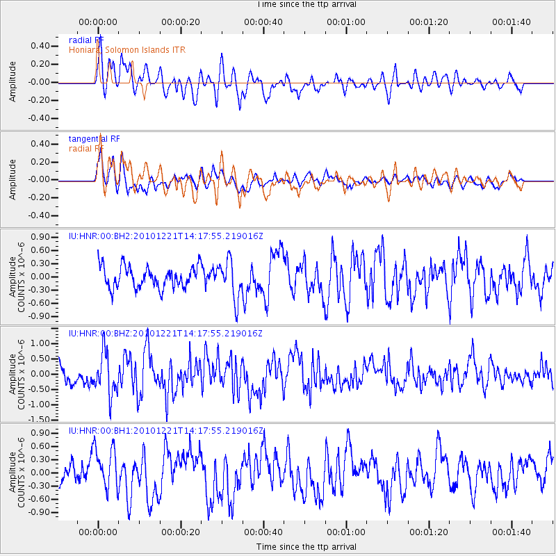
HNR Honiara, Solomon Islands - Earthquake Result Viewer
*The percent match for this event was below the threshold and hence no stack was calculated.
| Earthquake location: |
Off W Coast Of Northern Sumatra |
| Earthquake latitude/longitude: |
2.7/95.9 |
| Earthquake time(UTC): |
2010/12/21 (355) 14:07:48 GMT |
| Earthquake Depth: |
21 km |
| Earthquake Magnitude: |
5.8 MW, 5.7 MB, 5.8 MS, 5.8 MW |
| Earthquake Catalog/Contributor: |
NEIC PDE/NEIC PDE-M |
|
| Network: |
IU Global Seismograph Network (GSN - IRIS/USGS) |
| Station: |
HNR Honiara, Solomon Islands |
| Lat/Lon: |
9.44 S/159.95 E |
| Elevation: |
100 m |
|
| Distance: |
64.9 deg |
| Az: |
101.658 deg |
| Baz: |
277.461 deg |
| Ray Param: |
$rayparam |
*The percent match for this event was below the threshold and hence was not used in the summary stack. |
|
| Radial Match: |
64.93058 % |
| Radial Bump: |
400 |
| Transverse Match: |
80.96322 % |
| Transverse Bump: |
400 |
| SOD ConfigId: |
617450 |
| Insert Time: |
2013-10-01 15:52:10.830 +0000 |
| GWidth: |
2.5 |
| Max Bumps: |
400 |
| Tol: |
0.001 |
|
Signal To Noise
| Channel | StoN | STA | LTA |
| IU:HNR:00:BHZ:20101221T14:17:55.219016Z | 2.317619 | 6.977406E-7 | 3.010592E-7 |
| IU:HNR:00:BH1:20101221T14:17:55.219016Z | 1.7017717 | 4.7378884E-7 | 2.7840917E-7 |
| IU:HNR:00:BH2:20101221T14:17:55.219016Z | 1.8548054 | 4.4722216E-7 | 2.4111543E-7 |
| Arrivals |
| Ps | |
| PpPs | |
| PsPs/PpSs | |


