KEV Kevo, Finland - Earthquake Result Viewer
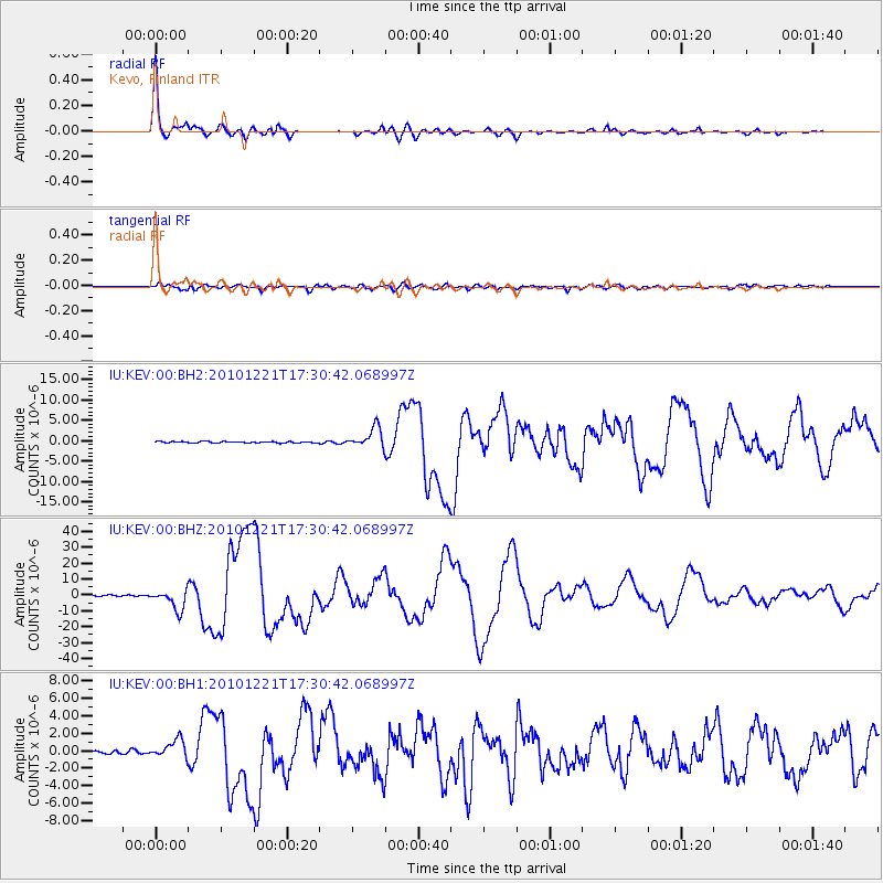
Earthquake location: Bonin Islands, Japan Region
Earthquake latitude/longitude: 26.9/143.7
Earthquake time(UTC): 2010/12/21 (355) 17:19:40 GMT
Earthquake Depth: 14 km
Earthquake Magnitude: 7.4 MW, 7.0 MB, 7.4 MW, 7.5 MS
Earthquake Catalog/Contributor: NEIC PDE/NEIC PDE-M
Network: IU Global Seismograph Network (GSN - IRIS/USGS)
Station: KEV Kevo, Finland
Lat/Lon: 69.76 N/27.00 E
Elevation: 100 m
Distance: 73.6 deg
Az: 341.086 deg
Baz: 56.268 deg
Ray Param: 0.052885372
Estimated Moho Depth: 22.25 km
Estimated Crust Vp/Vs: 2.09
Assumed Crust Vp: 6.622 km/s
Estimated Crust Vs: 3.169 km/s
Estimated Crust Poisson's Ratio: 0.35
Radial Match: 98.628914 %
Radial Bump: 367
Transverse Match: 93.27696 %
Transverse Bump: 400
SOD ConfigId: 617450
Insert Time: 2013-10-01 15:54:05.234 +0000
GWidth: 2.5
Max Bumps: 400
Tol: 0.001

Signal To Noise

ChannelStoNSTALTA
IU:KEV:00:BHZ:20101221T17:30:42.068997Z17.2381086.32069E-63.6666958E-7
IU:KEV:00:BH1:20101221T17:30:42.068997Z3.27817151.0430607E-63.1818368E-7
IU:KEV:00:BH2:20101221T17:30:42.068997Z12.5110082.4051099E-61.9223948E-7
Arrivals
Ps3.8 SECOND
PpPs10 SECOND
PsPs/PpSs14 SECOND