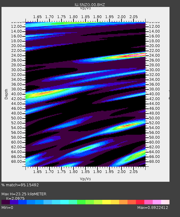
SNZO South Karori, New Zealand - Earthquake Result Viewer
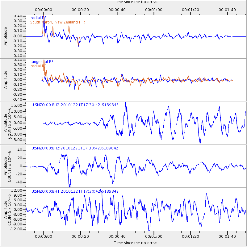
Earthquake location: Bonin Islands, Japan Region
Earthquake latitude/longitude: 26.9/143.7
Earthquake time(UTC): 2010/12/21 (355) 17:19:40 GMT
Earthquake Depth: 14 km
Earthquake Magnitude: 7.4 MW, 7.0 MB, 7.4 MW, 7.5 MS
Earthquake Catalog/Contributor: NEIC PDE/NEIC PDE-M
Network: IU Global Seismograph Network (GSN - IRIS/USGS)
Station: SNZO South Karori, New Zealand
Lat/Lon: 41.31 S/174.70 E
Elevation: 120 m
Distance: 73.7 deg
Az: 156.151 deg
Baz: 331.361 deg
Ray Param: 0.05282227
Estimated Moho Depth: 23.25 km
Estimated Crust Vp/Vs: 2.10
Assumed Crust Vp: 6.461 km/s
Estimated Crust Vs: 3.081 km/s
Estimated Crust Poisson's Ratio: 0.35
Radial Match: 95.15492 %
Radial Bump: 400
Transverse Match: 89.627655 %
Transverse Bump: 400
SOD ConfigId: 617450
Insert Time: 2013-10-01 15:54:11.880 +0000
GWidth: 2.5
Max Bumps: 400
Tol: 0.001

Signal To Noise

ChannelStoNSTALTA
IU:SNZO:00:BHZ:20101221T17:30:42.618984Z10.6171765.551852E-65.2291233E-7
IU:SNZO:00:BH1:20101221T17:30:42.618984Z3.00811271.8501734E-66.150612E-7
IU:SNZO:00:BH2:20101221T17:30:42.618984Z3.39426372.5069596E-67.385872E-7
Arrivals
Ps4.1 SECOND
PpPs11 SECOND
PsPs/PpSs15 SECOND