TUC Tucson, Arizona - Earthquake Result Viewer
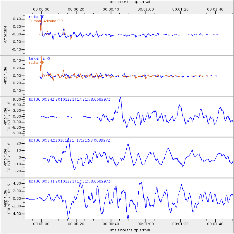
Earthquake location: Bonin Islands, Japan Region
Earthquake latitude/longitude: 26.9/143.7
Earthquake time(UTC): 2010/12/21 (355) 17:19:40 GMT
Earthquake Depth: 14 km
Earthquake Magnitude: 7.4 MW, 7.0 MB, 7.4 MW, 7.5 MS
Earthquake Catalog/Contributor: NEIC PDE/NEIC PDE-M
Network: IU Global Seismograph Network (GSN - IRIS/USGS)
Station: TUC Tucson, Arizona
Lat/Lon: 32.31 N/110.78 W
Elevation: 910 m
Distance: 87.9 deg
Az: 54.734 deg
Baz: 300.565 deg
Ray Param: 0.042998508
Estimated Moho Depth: 45.0 km
Estimated Crust Vp/Vs: 1.70
Assumed Crust Vp: 6.276 km/s
Estimated Crust Vs: 3.703 km/s
Estimated Crust Poisson's Ratio: 0.23
Radial Match: 97.56584 %
Radial Bump: 352
Transverse Match: 94.643295 %
Transverse Bump: 400
SOD ConfigId: 617450
Insert Time: 2013-10-01 15:54:18.911 +0000
GWidth: 2.5
Max Bumps: 400
Tol: 0.001

Signal To Noise

ChannelStoNSTALTA
IU:TUC:00:BHZ:20101221T17:31:58.068997Z7.37919862.463201E-63.3380334E-7
IU:TUC:00:BH1:20101221T17:31:58.068997Z3.59058365.972341E-71.6633342E-7
IU:TUC:00:BH2:20101221T17:31:58.068997Z5.5677719.1525123E-71.6438378E-7
Arrivals
Ps5.1 SECOND
PpPs19 SECOND
PsPs/PpSs24 SECOND