
HNR Honiara, Solomon Islands - Earthquake Result Viewer
| ||||||||||||||||||
| ||||||||||||||||||
| ||||||||||||||||||
|
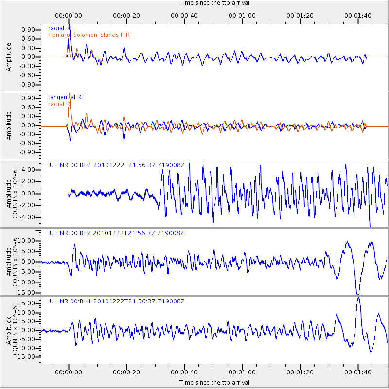
Signal To Noise
| Channel | StoN | STA | LTA |
| IU:HNR:00:BHZ:20101222T21:56:37.719008Z | 14.576913 | 4.2517077E-6 | 2.9167407E-7 |
| IU:HNR:00:BH1:20101222T21:56:37.719008Z | 7.9021554 | 3.8094358E-6 | 4.820755E-7 |
| IU:HNR:00:BH2:20101222T21:56:37.719008Z | 5.4318585 | 2.1834753E-6 | 4.0197574E-7 |
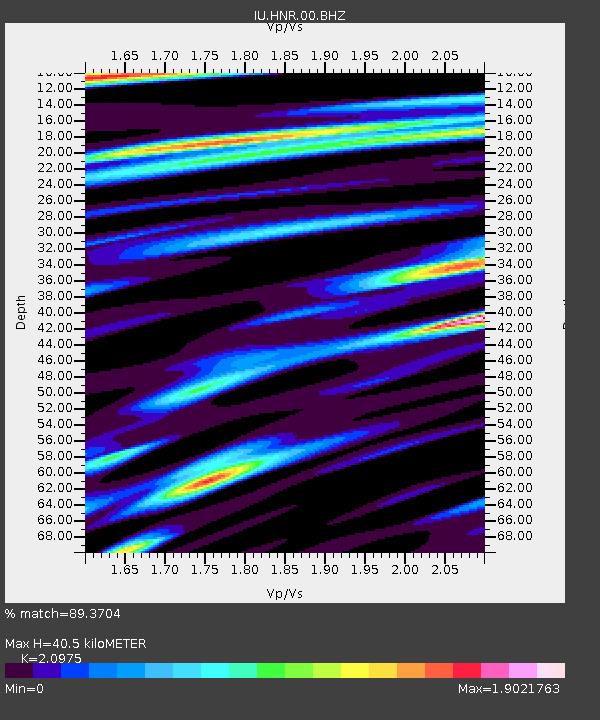
| Arrivals | |
| Ps | 7.6 SECOND |
| PpPs | 19 SECOND |
| PsPs/PpSs | 27 SECOND |

