You are here: Home > Network List > II - Global Seismograph Network (GSN - IRIS/IDA) Stations List
> Station PFO Pinon Flat, California, USA > Earthquake Result Viewer
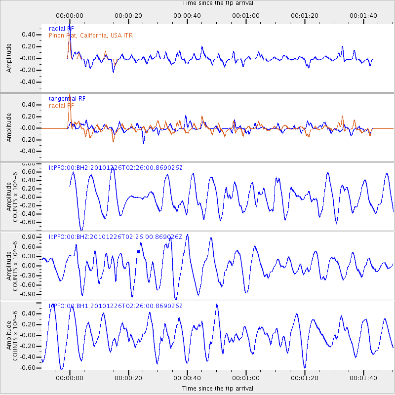
PFO Pinon Flat, California, USA - Earthquake Result Viewer
*The percent match for this event was below the threshold and hence no stack was calculated.
| Earthquake location: |
Vanuatu Islands |
| Earthquake latitude/longitude: |
-19.6/168.3 |
| Earthquake time(UTC): |
2010/12/26 (360) 02:13:37 GMT |
| Earthquake Depth: |
13 km |
| Earthquake Magnitude: |
5.7 MW, 5.7 MS, 5.8 MB, 6.0 MW |
| Earthquake Catalog/Contributor: |
NEIC PDE/NEIC PDE-M |
|
| Network: |
II Global Seismograph Network (GSN - IRIS/IDA) |
| Station: |
PFO Pinon Flat, California, USA |
| Lat/Lon: |
33.61 N/116.46 W |
| Elevation: |
1280 m |
|
| Distance: |
89.1 deg |
| Az: |
53.82 deg |
| Baz: |
245.752 deg |
| Ray Param: |
$rayparam |
*The percent match for this event was below the threshold and hence was not used in the summary stack. |
|
| Radial Match: |
53.148533 % |
| Radial Bump: |
400 |
| Transverse Match: |
56.562668 % |
| Transverse Bump: |
400 |
| SOD ConfigId: |
617450 |
| Insert Time: |
2013-10-01 16:18:33.026 +0000 |
| GWidth: |
2.5 |
| Max Bumps: |
400 |
| Tol: |
0.001 |
|
Signal To Noise
| Channel | StoN | STA | LTA |
| II:PFO:00:BHZ:20101226T02:26:00.869026Z | 1.4207712 | 4.8171927E-7 | 3.3905476E-7 |
| II:PFO:00:BH1:20101226T02:26:00.869026Z | 1.664937 | 3.6195274E-7 | 2.1739726E-7 |
| II:PFO:00:BH2:20101226T02:26:00.869026Z | 0.8528 | 3.167342E-7 | 3.71405E-7 |
| Arrivals |
| Ps | |
| PpPs | |
| PsPs/PpSs | |


