You are here: Home > Network List > IU - Global Seismograph Network (GSN - IRIS/USGS) Stations List
> Station JOHN Johnston Island, USA > Earthquake Result Viewer
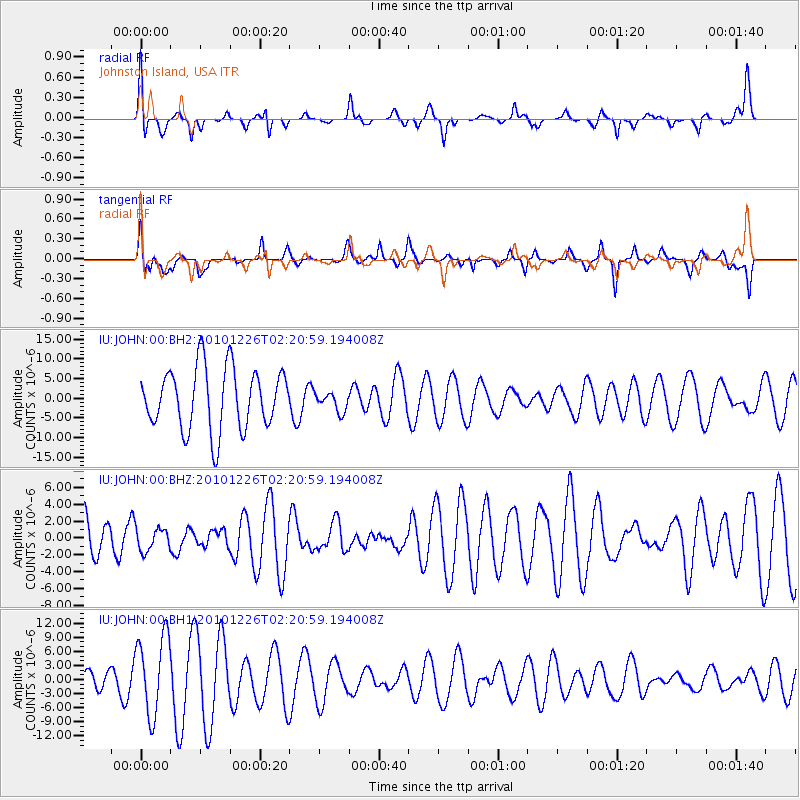
JOHN Johnston Island, USA - Earthquake Result Viewer
*The percent match for this event was below the threshold and hence no stack was calculated.
| Earthquake location: |
Vanuatu Islands |
| Earthquake latitude/longitude: |
-19.6/168.3 |
| Earthquake time(UTC): |
2010/12/26 (360) 02:13:37 GMT |
| Earthquake Depth: |
13 km |
| Earthquake Magnitude: |
5.7 MW, 5.7 MS, 5.8 MB, 6.0 MW |
| Earthquake Catalog/Contributor: |
NEIC PDE/NEIC PDE-M |
|
| Network: |
IU Global Seismograph Network (GSN - IRIS/USGS) |
| Station: |
JOHN Johnston Island, USA |
| Lat/Lon: |
16.73 N/169.53 W |
| Elevation: |
2.0 m |
|
| Distance: |
42.2 deg |
| Az: |
32.598 deg |
| Baz: |
212.007 deg |
| Ray Param: |
$rayparam |
*The percent match for this event was below the threshold and hence was not used in the summary stack. |
|
| Radial Match: |
45.826164 % |
| Radial Bump: |
400 |
| Transverse Match: |
53.210217 % |
| Transverse Bump: |
400 |
| SOD ConfigId: |
617450 |
| Insert Time: |
2013-10-01 16:18:41.626 +0000 |
| GWidth: |
2.5 |
| Max Bumps: |
400 |
| Tol: |
0.001 |
|
Signal To Noise
| Channel | StoN | STA | LTA |
| IU:JOHN:00:BHZ:20101226T02:20:59.194008Z | 0.33043095 | 1.3244966E-6 | 4.0083914E-6 |
| IU:JOHN:00:BH1:20101226T02:20:59.194008Z | 3.3657591 | 8.496878E-6 | 2.5245056E-6 |
| IU:JOHN:00:BH2:20101226T02:20:59.194008Z | 0.3123313 | 2.4351496E-6 | 7.796689E-6 |
| Arrivals |
| Ps | |
| PpPs | |
| PsPs/PpSs | |


