You are here: Home > Network List > IU - Global Seismograph Network (GSN - IRIS/USGS) Stations List
> Station RAR Rarotonga, Cook Islands > Earthquake Result Viewer
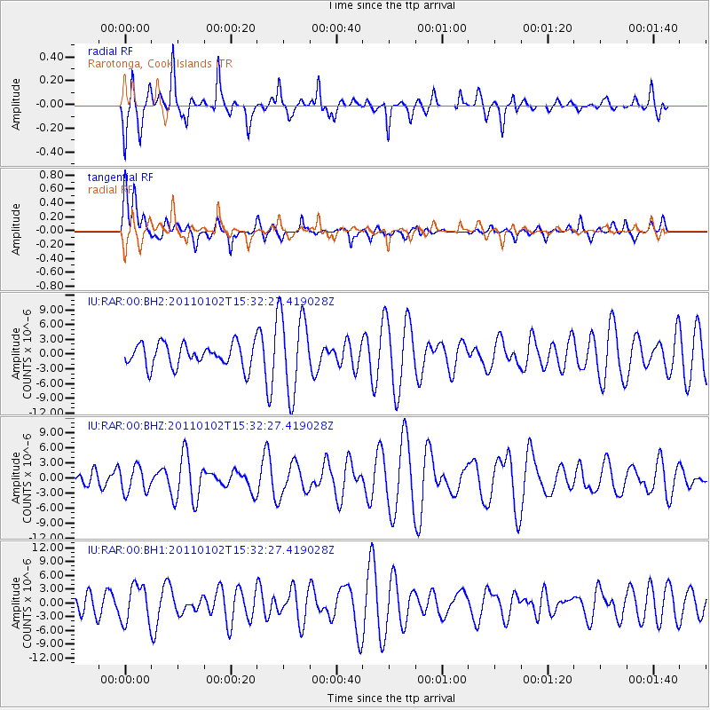
RAR Rarotonga, Cook Islands - Earthquake Result Viewer
*The percent match for this event was below the threshold and hence no stack was calculated.
| Earthquake location: |
Southern Sumatra, Indonesia |
| Earthquake latitude/longitude: |
-4.5/101.4 |
| Earthquake time(UTC): |
2011/01/02 (002) 15:19:31 GMT |
| Earthquake Depth: |
22 km |
| Earthquake Magnitude: |
5.7 MB, 5.6 MS, 5.8 MW, 5.7 MW |
| Earthquake Catalog/Contributor: |
WHDF/NEIC |
|
| Network: |
IU Global Seismograph Network (GSN - IRIS/USGS) |
| Station: |
RAR Rarotonga, Cook Islands |
| Lat/Lon: |
21.21 S/159.77 W |
| Elevation: |
28 m |
|
| Distance: |
96.6 deg |
| Az: |
111.846 deg |
| Baz: |
262.661 deg |
| Ray Param: |
$rayparam |
*The percent match for this event was below the threshold and hence was not used in the summary stack. |
|
| Radial Match: |
46.91763 % |
| Radial Bump: |
341 |
| Transverse Match: |
44.97756 % |
| Transverse Bump: |
400 |
| SOD ConfigId: |
617450 |
| Insert Time: |
2013-10-01 16:38:36.676 +0000 |
| GWidth: |
2.5 |
| Max Bumps: |
400 |
| Tol: |
0.001 |
|
Signal To Noise
| Channel | StoN | STA | LTA |
| IU:RAR:00:BHZ:20110102T15:32:27.419028Z | 1.0933884 | 2.591509E-6 | 2.370163E-6 |
| IU:RAR:00:BH1:20110102T15:32:27.419028Z | 1.060382 | 4.1704347E-6 | 3.9329548E-6 |
| IU:RAR:00:BH2:20110102T15:32:27.419028Z | 3.5277667 | 8.197552E-6 | 2.323723E-6 |
| Arrivals |
| Ps | |
| PpPs | |
| PsPs/PpSs | |


