GTBY Guantanamo Bay, Cuba - Earthquake Result Viewer
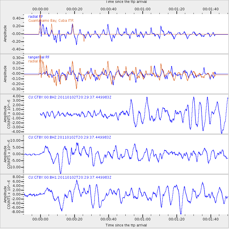
Earthquake location: Near Coast Of Central Chile
Earthquake latitude/longitude: -38.4/-73.3
Earthquake time(UTC): 2011/01/02 (002) 20:20:17 GMT
Earthquake Depth: 24 km
Earthquake Magnitude: 6.6 MB, 7.1 MS, 7.1 MW, 7.0 MW
Earthquake Catalog/Contributor: WHDF/NEIC
Network: CU Caribbean Network (USGS)
Station: GTBY Guantanamo Bay, Cuba
Lat/Lon: 19.93 N/75.11 W
Elevation: 79 m
Distance: 58.0 deg
Az: 358.02 deg
Baz: 178.345 deg
Ray Param: 0.06309883
Estimated Moho Depth: 16.25 km
Estimated Crust Vp/Vs: 1.60
Assumed Crust Vp: 6.048 km/s
Estimated Crust Vs: 3.78 km/s
Estimated Crust Poisson's Ratio: 0.18
Radial Match: 83.57855 %
Radial Bump: 400
Transverse Match: 75.87803 %
Transverse Bump: 400
SOD ConfigId: 617450
Insert Time: 2013-10-01 16:39:50.947 +0000
GWidth: 2.5
Max Bumps: 400
Tol: 0.001

Signal To Noise

ChannelStoNSTALTA
CU:GTBY:00:BHZ:20110102T20:29:37.449983Z7.31433963.426439E-64.68455E-7
CU:GTBY:00:BH1:20110102T20:29:37.449983Z3.7560251.5526306E-64.1337063E-7
CU:GTBY:00:BH2:20110102T20:29:37.449983Z1.15216833.8476526E-73.3394883E-7
Arrivals
Ps1.7 SECOND
PpPs6.7 SECOND
PsPs/PpSs8.3 SECOND